Risher Topo Map Arkansas
To zoom in, hover over the map of Risher
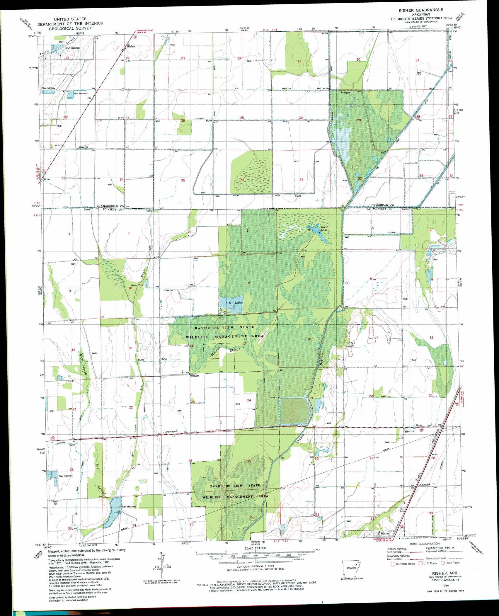
USGS Topo Quad 35090f8 - 1:24,000 scale
| Topo Map Name: | Risher |
| USGS Topo Quad ID: | 35090f8 |
| Print Size: | ca. 21 1/4" wide x 27" high |
| Southeast Coordinates: | 35.625° N latitude / 90.875° W longitude |
| Map Center Coordinates: | 35.6875° N latitude / 90.9375° W longitude |
| U.S. State: | AR |
| Filename: | o35090f8.jpg |
| Download Map JPG Image: | Risher topo map 1:24,000 scale |
| Map Type: | Topographic |
| Topo Series: | 7.5´ |
| Map Scale: | 1:24,000 |
| Source of Map Images: | United States Geological Survey (USGS) |
| Alternate Map Versions: |
Risher AR 1980, updated 1980 Download PDF Buy paper map Risher AR 2011 Download PDF Buy paper map Risher AR 2014 Download PDF Buy paper map |
1:24,000 Topo Quads surrounding Risher
Strangers Home |
Alicia |
Podo Creek |
Bono |
Lorado |
Swifton West |
Swifton East |
Cash |
Herman |
Jonesboro |
Tuckerman |
Grubbs |
Risher |
Otwell |
Greenfield |
Auvergne |
Amagon |
Weiner |
Powers Slough |
Harrisburg |
Tupelo |
Beedeville |
Hickory Ridge |
Cherry Valley West |
Cherry Valley East |
> Back to 35090e1 at 1:100,000 scale
> Back to 35090a1 at 1:250,000 scale
> Back to U.S. Topo Maps home
Risher topo map: Gazetteer
Risher: Canals
Angle Ditch Lateral Number 4 elevation 72m 236′Big Creek Ditch Main Ditch elevation 71m 232′
Elm Ditch elevation 72m 236′
Farley Ditch elevation 71m 232′
Long Pond Or-Cache Ditch elevation 69m 226′
Risher: Lakes
Hood Lake elevation 70m 229′Risher: Populated Places
McDaniel elevation 73m 239′Risher elevation 73m 239′
Risher: Reservoirs
O K Lake elevation 71m 232′Risher: Streams
Ash Spread elevation 69m 226′Big Creek elevation 71m 232′
Coward Slough elevation 72m 236′
Gum Slough elevation 68m 223′
Maple Slough elevation 69m 226′
Morgan Slough elevation 71m 232′
Risher digital topo map on disk
Buy this Risher topo map showing relief, roads, GPS coordinates and other geographical features, as a high-resolution digital map file on DVD: