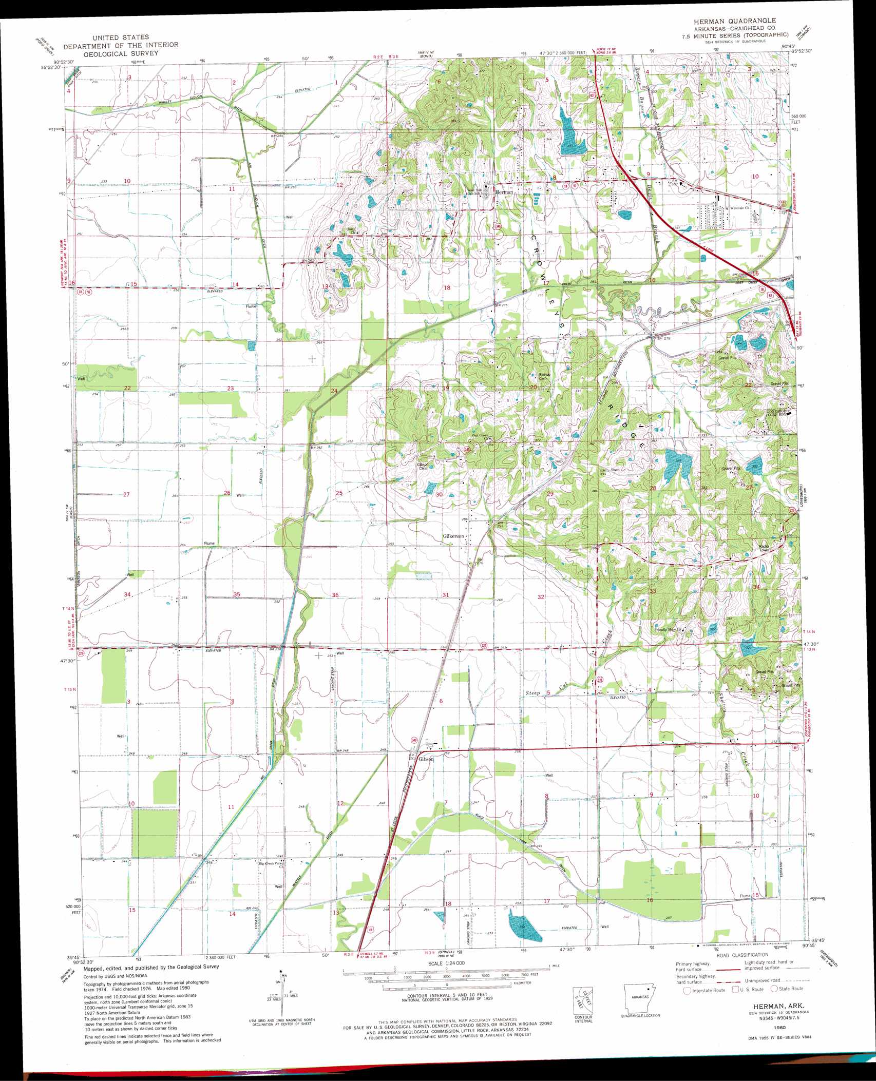
Herman Topo Map Arkansas
To zoom in, hover over the map of Herman
USGS Topo Quad 35090g7 - 1:24,000 scale
| Topo Map Name: | Herman |
| USGS Topo Quad ID: | 35090g7 |
| Print Size: | ca. 21 1/4" wide x 27" high |
| Southeast Coordinates: | 35.75° N latitude / 90.75° W longitude |
| Map Center Coordinates: | 35.8125° N latitude / 90.8125° W longitude |
| U.S. State: | AR |
| Filename: | o35090g7.jpg |
| Download Map JPG Image: | Herman topo map 1:24,000 scale |
| Map Type: | Topographic |
| Topo Series: | 7.5´ |
| Map Scale: | 1:24,000 |
| Source of Map Images: | United States Geological Survey (USGS) |
| Alternate Map Versions: |
Herman AR 1980, updated 1980 Download PDF Buy paper map Herman AR 2011 Download PDF Buy paper map Herman AR 2014 Download PDF Buy paper map |
1:24,000 Topo Quads surrounding Herman
Black Rock |
Walnut Ridge |
Walnut Ridge Se |
Walcott |
Paragould West |
Alicia |
Podo Creek |
Bono |
Lorado |
Brookland |
Swifton East |
Cash |
Herman |
Jonesboro |
Needham |
Grubbs |
Risher |
Otwell |
Greenfield |
Trumann |
Amagon |
Weiner |
Powers Slough |
Harrisburg |
Mccormick |
> Back to 35090e1 at 1:100,000 scale
> Back to 35090a1 at 1:250,000 scale
> Back to U.S. Topo Maps home
Herman topo map: Gazetteer
Herman: Canals
Ark Slough Ditch elevation 75m 246′Big Creek Ditch elevation 77m 252′
Black Fork Ditch elevation 77m 252′
Emerson Ditch Lateral Number 2 elevation 75m 246′
Whaley Slough Ditch elevation 74m 242′
Herman: Dams
Big Creek Site 11 Dam elevation 94m 308′Big Creek Site 13 Dam elevation 91m 298′
Big Creek Site 14 Dam elevation 130m 426′
Big Creek Site 21 Dam elevation 110m 360′
Big Creek Site 22 Dam elevation 117m 383′
Cole Pond Dam elevation 90m 295′
Herman: Populated Places
Gibson elevation 77m 252′Gilkerson elevation 86m 282′
Herman elevation 91m 298′
Nemo elevation 74m 242′
Scarb (historical) elevation 74m 242′
Herman: Reservoirs
Big Creek Site 11 Reservoir elevation 94m 308′Big Creek Site 13 Reservoir elevation 91m 298′
Big Creek Site 14 Reservoir elevation 130m 426′
Big Creek Site 21 Reservoir elevation 110m 360′
Big Creek Site 22 Reservoir elevation 117m 383′
Cole Pond elevation 90m 295′
Herman: Streams
Davis Branch elevation 81m 265′Kirksey Creek elevation 81m 265′
Rogers Bayou elevation 87m 285′
Rogers Branch elevation 84m 275′
Shelton Creek elevation 75m 246′
Steep Cut Creek elevation 75m 246′
Herman digital topo map on disk
Buy this Herman topo map showing relief, roads, GPS coordinates and other geographical features, as a high-resolution digital map file on DVD: