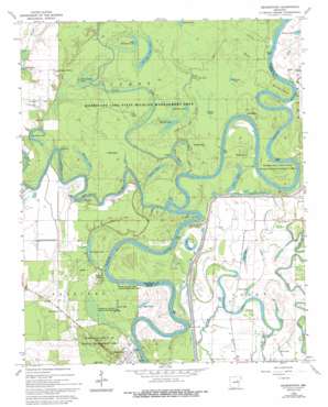
Georgetown Topo Map Arkansas
To zoom in, hover over the map of Georgetown
USGS Topo Quad 35091b4 - 1:24,000 scale
| Topo Map Name: | Georgetown |
| USGS Topo Quad ID: | 35091b4 |
| Print Size: | ca. 21 1/4" wide x 27" high |
| Southeast Coordinates: | 35.125° N latitude / 91.375° W longitude |
| Map Center Coordinates: | 35.1875° N latitude / 91.4375° W longitude |
| U.S. State: | AR |
| Filename: | o35091b4.jpg |
| Download Map JPG Image: | Georgetown topo map 1:24,000 scale |
| Map Type: | Topographic |
| Topo Series: | 7.5´ |
| Map Scale: | 1:24,000 |
| Source of Map Images: | United States Geological Survey (USGS) |
| Alternate Map Versions: |
Georgetown AR 1968, updated 1970 Download PDF Buy paper map Georgetown AR 1968, updated 1974 Download PDF Buy paper map Georgetown AR 1968, updated 1986 Download PDF Buy paper map Georgetown AR 1968, updated 1993 Download PDF Buy paper map Georgetown AR 1968, updated 1993 Download PDF Buy paper map Georgetown AR 2011 Download PDF Buy paper map Georgetown AR 2014 Download PDF Buy paper map |
1:24,000 Topo Quads surrounding Georgetown
> Back to 35091a1 at 1:100,000 scale
> Back to 35090a1 at 1:250,000 scale
> Back to U.S. Topo Maps home
Georgetown topo map: Gazetteer
Georgetown: Bends
Clear Lake Bend elevation 56m 183′Devils Elbow elevation 56m 183′
Duncan Bend elevation 54m 177′
Ealand Bend elevation 56m 183′
Nine Mile Bend elevation 58m 190′
Postal Bend elevation 55m 180′
Taylor Bend elevation 55m 180′
Georgetown: Capes
Graham Point elevation 53m 173′Gravelly Point elevation 61m 200′
Georgetown: Guts
Kellum Slough elevation 57m 187′Georgetown: Lakes
Big Bell Lake elevation 58m 190′Big Hurricane Lake elevation 58m 190′
Britt Lake elevation 56m 183′
Brushy Lake elevation 59m 193′
Clear Lake elevation 57m 187′
Crane Lake elevation 58m 190′
Cunningham Pond elevation 61m 200′
Dollar Pond elevation 56m 183′
Fish Lake elevation 58m 190′
Gum Pond elevation 59m 193′
Hackelton Lake elevation 61m 200′
Hat Lake elevation 60m 196′
Honey Lake elevation 56m 183′
Little Bell Lake elevation 57m 187′
Little Green Tom Lake elevation 59m 193′
Little Hurricane Lake elevation 59m 193′
Log Lake elevation 57m 187′
Lost Lake elevation 57m 187′
Mallard Pond elevation 57m 187′
Mud Lake elevation 55m 180′
Mud Pond elevation 58m 190′
Newmann Lake elevation 57m 187′
Ryan Lake elevation 54m 177′
Sevenmile Lake elevation 56m 183′
Three Sisters Lake elevation 58m 190′
Turtle Lake elevation 57m 187′
Whirl Lake elevation 55m 180′
Wolf Lake elevation 59m 193′
Georgetown: Parks
Hurricane Lake State Game Area elevation 59m 193′Georgetown: Populated Places
Georgetown elevation 62m 203′Mitchell Corner elevation 65m 213′
Nimmo elevation 58m 190′
Georgetown: Post Offices
Georgetown Post Office (historical) elevation 60m 196′Georgetown: Streams
Bear Slough elevation 59m 193′Glaise Creek elevation 58m 190′
Little Green Tom Slough elevation 55m 180′
Little Red River elevation 53m 173′
Whirl Creek elevation 55m 180′
Georgetown digital topo map on disk
Buy this Georgetown topo map showing relief, roads, GPS coordinates and other geographical features, as a high-resolution digital map file on DVD:


