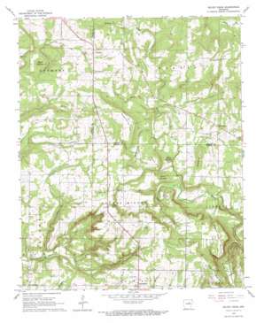
Velvet Ridge Topo Map Arkansas
To zoom in, hover over the map of Velvet Ridge
USGS Topo Quad 35091d5 - 1:24,000 scale
| Topo Map Name: | Velvet Ridge |
| USGS Topo Quad ID: | 35091d5 |
| Print Size: | ca. 21 1/4" wide x 27" high |
| Southeast Coordinates: | 35.375° N latitude / 91.5° W longitude |
| Map Center Coordinates: | 35.4375° N latitude / 91.5625° W longitude |
| U.S. State: | AR |
| Filename: | o35091d5.jpg |
| Download Map JPG Image: | Velvet Ridge topo map 1:24,000 scale |
| Map Type: | Topographic |
| Topo Series: | 7.5´ |
| Map Scale: | 1:24,000 |
| Source of Map Images: | United States Geological Survey (USGS) |
| Alternate Map Versions: |
Velvet Ridge AR 1965, updated 1966 Download PDF Buy paper map Velvet Ridge AR 1965, updated 1973 Download PDF Buy paper map Velvet Ridge AR 2011 Download PDF Buy paper map Velvet Ridge AR 2014 Download PDF Buy paper map |
1:24,000 Topo Quads surrounding Velvet Ridge
> Back to 35091a1 at 1:100,000 scale
> Back to 35090a1 at 1:250,000 scale
> Back to U.S. Topo Maps home
Velvet Ridge topo map: Gazetteer
Velvet Ridge: Dams
Buddy Lake Dam elevation 148m 485′Doctor Jacksons Lake Dam elevation 135m 442′
Ranson Lake Dam elevation 171m 561′
Velvet Ridge: Populated Places
Adelaide (historical) elevation 192m 629′Bliss (historical) elevation 146m 479′
Denmark elevation 178m 583′
Heffington elevation 138m 452′
Twentythree elevation 183m 600′
Velvet Ridge elevation 196m 643′
Velvet Ridge: Reservoirs
Buddy Lake elevation 148m 485′Doctor Jacksons Lake elevation 135m 442′
Ranson Lake elevation 171m 561′
Velvet Ridge: Streams
Caplener Branch elevation 111m 364′Fussy Branch elevation 117m 383′
Hurricane Branch elevation 117m 383′
Pine Creek elevation 101m 331′
Sugar Creek elevation 104m 341′
Whippoorwill Branch elevation 115m 377′
Velvet Ridge: Summits
Boyce Hill elevation 169m 554′Buzzard Roost Mountain elevation 183m 600′
Mason Hill elevation 187m 613′
Round Mountain elevation 147m 482′
Round Mountain elevation 198m 649′
Russell Mountain elevation 225m 738′
Short Mountain elevation 175m 574′
Soapstone Hill elevation 171m 561′
Throckmorton Hill elevation 193m 633′
Velvet Ridge: Valleys
Wolf Hollow elevation 73m 239′Velvet Ridge digital topo map on disk
Buy this Velvet Ridge topo map showing relief, roads, GPS coordinates and other geographical features, as a high-resolution digital map file on DVD:


