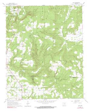
Huff Topo Map Arkansas
To zoom in, hover over the map of Huff
USGS Topo Quad 35091e5 - 1:24,000 scale
| Topo Map Name: | Huff |
| USGS Topo Quad ID: | 35091e5 |
| Print Size: | ca. 21 1/4" wide x 27" high |
| Southeast Coordinates: | 35.5° N latitude / 91.5° W longitude |
| Map Center Coordinates: | 35.5625° N latitude / 91.5625° W longitude |
| U.S. State: | AR |
| Filename: | o35091e5.jpg |
| Download Map JPG Image: | Huff topo map 1:24,000 scale |
| Map Type: | Topographic |
| Topo Series: | 7.5´ |
| Map Scale: | 1:24,000 |
| Source of Map Images: | United States Geological Survey (USGS) |
| Alternate Map Versions: |
Huff AR 1965, updated 1966 Download PDF Buy paper map Huff AR 1965, updated 1990 Download PDF Buy paper map Huff AR 2011 Download PDF Buy paper map Huff AR 2014 Download PDF Buy paper map |
1:24,000 Topo Quads surrounding Huff
> Back to 35091e1 at 1:100,000 scale
> Back to 35090a1 at 1:250,000 scale
> Back to U.S. Topo Maps home
Huff topo map: Gazetteer
Huff: Cliffs
Wildcat Bluff elevation 144m 472′Huff: Populated Places
Departe (historical) elevation 78m 255′Huff elevation 105m 344′
Midway elevation 185m 606′
Union Hill elevation 216m 708′
Huff: Springs
Stanley Spring elevation 200m 656′Huff: Streams
Bailey Creek elevation 72m 236′Bullock Branch elevation 123m 403′
Dog Lick Branch elevation 87m 285′
McCoy Branch elevation 86m 282′
Piney Creek elevation 88m 288′
Shoat Branch elevation 128m 419′
Sugar Creek elevation 90m 295′
Village Creek elevation 71m 232′
Huff: Summits
Bald Knob elevation 259m 849′Major Harris Mountain elevation 194m 636′
Salado Mountain elevation 162m 531′
Uncle Joe Warren Mountain elevation 259m 849′
Huff: Valleys
Gray Hollow elevation 115m 377′Hook Hollow elevation 111m 364′
Howl Hollow elevation 92m 301′
Mills Hollow elevation 102m 334′
Sinclair Hollow elevation 115m 377′
Turkey Pen Hollow elevation 100m 328′
Huff digital topo map on disk
Buy this Huff topo map showing relief, roads, GPS coordinates and other geographical features, as a high-resolution digital map file on DVD:


