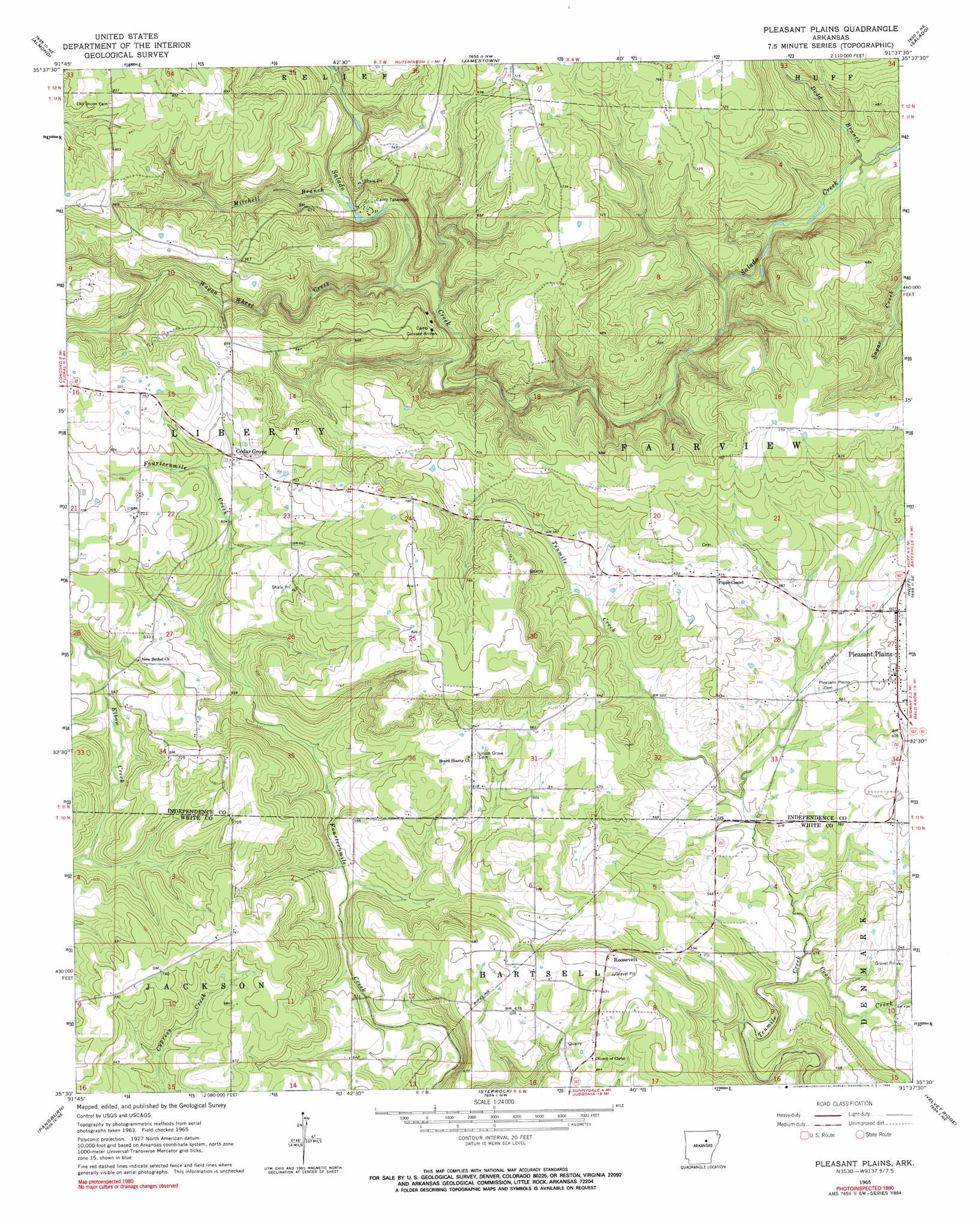
Pleasant Plains Topo Map Arkansas
To zoom in, hover over the map of Pleasant Plains
USGS Topo Quad 35091e6 - 1:24,000 scale
| Topo Map Name: | Pleasant Plains |
| USGS Topo Quad ID: | 35091e6 |
| Print Size: | ca. 21 1/4" wide x 27" high |
| Southeast Coordinates: | 35.5° N latitude / 91.625° W longitude |
| Map Center Coordinates: | 35.5625° N latitude / 91.6875° W longitude |
| U.S. State: | AR |
| Filename: | o35091e6.jpg |
| Download Map JPG Image: | Pleasant Plains topo map 1:24,000 scale |
| Map Type: | Topographic |
| Topo Series: | 7.5´ |
| Map Scale: | 1:24,000 |
| Source of Map Images: | United States Geological Survey (USGS) |
| Alternate Map Versions: |
Pleasant Plains AR 1965, updated 1966 Download PDF Buy paper map Pleasant Plains AR 2011 Download PDF Buy paper map Pleasant Plains AR 2014 Download PDF Buy paper map |
1:24,000 Topo Quads surrounding Pleasant Plains
Marcella |
Bethesda |
Batesville |
Sulphur Rock |
Charlotte |
Drasco |
Concord |
Jamestown |
Salado |
Newark |
Greers Ferry Dam |
Floral |
Pleasant Plains |
Huff |
Olyphant |
West Pangburn |
Pangburn |
Steprock |
Velvet Ridge |
Bradford |
Sidon |
Letona |
Judsonia |
Bald Knob |
Augusta Sw |
> Back to 35091e1 at 1:100,000 scale
> Back to 35090a1 at 1:250,000 scale
> Back to U.S. Topo Maps home
Pleasant Plains topo map: Gazetteer
Pleasant Plains: Populated Places
Cedar Grove elevation 209m 685′Pleasant Plains elevation 187m 613′
Roosevelt elevation 220m 721′
Wrenton elevation 150m 492′
Pleasant Plains: Streams
Bear Branch elevation 126m 413′Coon Creek elevation 147m 482′
Dodd Branch elevation 95m 311′
Fletcher Branch elevation 169m 554′
Mitchell Branch elevation 143m 469′
Wagon Wheel Creek elevation 138m 452′
Pleasant Plains digital topo map on disk
Buy this Pleasant Plains topo map showing relief, roads, GPS coordinates and other geographical features, as a high-resolution digital map file on DVD: