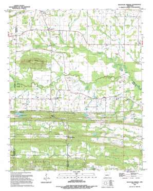
Mountain Springs Topo Map Arkansas
To zoom in, hover over the map of Mountain Springs
USGS Topo Quad 35092a1 - 1:24,000 scale
| Topo Map Name: | Mountain Springs |
| USGS Topo Quad ID: | 35092a1 |
| Print Size: | ca. 21 1/4" wide x 27" high |
| Southeast Coordinates: | 35° N latitude / 92° W longitude |
| Map Center Coordinates: | 35.0625° N latitude / 92.0625° W longitude |
| U.S. State: | AR |
| Filename: | o35092a1.jpg |
| Download Map JPG Image: | Mountain Springs topo map 1:24,000 scale |
| Map Type: | Topographic |
| Topo Series: | 7.5´ |
| Map Scale: | 1:24,000 |
| Source of Map Images: | United States Geological Survey (USGS) |
| Alternate Map Versions: |
Mountain Springs AR 1963, updated 1964 Download PDF Buy paper map Mountain Springs AR 1963, updated 1976 Download PDF Buy paper map Mountain Springs AR 1963, updated 1982 Download PDF Buy paper map Mountain Springs AR 1994, updated 1994 Download PDF Buy paper map Mountain Springs AR 2011 Download PDF Buy paper map Mountain Springs AR 2014 Download PDF Buy paper map |
1:24,000 Topo Quads surrounding Mountain Springs
> Back to 35092a1 at 1:100,000 scale
> Back to 35092a1 at 1:250,000 scale
> Back to U.S. Topo Maps home
Mountain Springs topo map: Gazetteer
Mountain Springs: Dams
Arkansas Noname 20 Dam elevation 109m 357′Arkansas Noname Four Dam elevation 119m 390′
Catfish Lake Dam elevation 101m 331′
Indianhead Lake Dam elevation 104m 341′
Omni Lake Dam elevation 112m 367′
Omni Lake Number Two Dam elevation 104m 341′
Rick Lake Dam elevation 93m 305′
Troutman Lake Dam elevation 78m 255′
Mountain Springs: Gaps
Fleming Gap elevation 104m 341′Poland Gap elevation 104m 341′
Mountain Springs: Populated Places
Bailey Addition elevation 115m 377′Camelot Acres elevation 116m 380′
De Boer elevation 110m 360′
Gap Rancheros elevation 161m 528′
McDermott Addition elevation 99m 324′
Mountain Springs elevation 120m 393′
Oakridge Estates elevation 87m 285′
Opal elevation 79m 259′
Ridgecrest elevation 96m 314′
Spring Valley elevation 100m 328′
Wildwood elevation 104m 341′
Woodlawn Addition elevation 116m 380′
Mountain Springs: Reservoirs
Catfish Lake elevation 101m 331′Indian Head Lake elevation 104m 341′
Indian Head Lake - South elevation 119m 390′
John Thompson Lake elevation 109m 357′
Omni Lake elevation 112m 367′
Omni Lake Number Two elevation 104m 341′
Rick Lake elevation 93m 305′
Troutman Lake elevation 78m 255′
Mountain Springs: Ridges
Lewisburg Ridge elevation 118m 387′Mountain Springs: Streams
Boone Branch elevation 82m 269′Deans Branch elevation 79m 259′
Harston Branch elevation 78m 255′
Jacksnipe Branch elevation 72m 236′
Jackson Branch elevation 78m 255′
Lewisburg Branch elevation 87m 285′
Little Cypress Creek elevation 81m 265′
Little Cypress Creek elevation 71m 232′
Sawmill Branch elevation 69m 226′
Mountain Springs: Summits
Haymes Hill elevation 147m 482′Round Mountain elevation 173m 567′
Sims Hill elevation 130m 426′
Mountain Springs digital topo map on disk
Buy this Mountain Springs topo map showing relief, roads, GPS coordinates and other geographical features, as a high-resolution digital map file on DVD:


