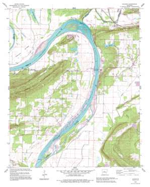
Gleason Topo Map Arkansas
To zoom in, hover over the map of Gleason
USGS Topo Quad 35092a5 - 1:24,000 scale
| Topo Map Name: | Gleason |
| USGS Topo Quad ID: | 35092a5 |
| Print Size: | ca. 21 1/4" wide x 27" high |
| Southeast Coordinates: | 35° N latitude / 92.5° W longitude |
| Map Center Coordinates: | 35.0625° N latitude / 92.5625° W longitude |
| U.S. State: | AR |
| Filename: | o35092a5.jpg |
| Download Map JPG Image: | Gleason topo map 1:24,000 scale |
| Map Type: | Topographic |
| Topo Series: | 7.5´ |
| Map Scale: | 1:24,000 |
| Source of Map Images: | United States Geological Survey (USGS) |
| Alternate Map Versions: |
Gleason AR 1961, updated 1962 Download PDF Buy paper map Gleason AR 1961, updated 1975 Download PDF Buy paper map Gleason AR 1961, updated 1982 Download PDF Buy paper map Gleason AR 1991, updated 1995 Download PDF Buy paper map Gleason AR 2011 Download PDF Buy paper map Gleason AR 2014 Download PDF Buy paper map |
1:24,000 Topo Quads surrounding Gleason
> Back to 35092a1 at 1:100,000 scale
> Back to 35092a1 at 1:250,000 scale
> Back to U.S. Topo Maps home
Gleason topo map: Gazetteer
Gleason: Bends
Portland Bottoms elevation 87m 285′Gleason: Dams
Arkansas Noname 194 Dam elevation 83m 272′Jones Lake Dam Number Two elevation 86m 282′
Lake Carol-Dan Dam elevation 95m 311′
Ouachita Creek Watershed Site One Dam elevation 82m 269′
Ouachita Creek Watershed Site Two Dam elevation 83m 272′
Toad Suck Ferry Lock and Dam elevation 84m 275′
Tupelo Bayou Site One Dam elevation 83m 272′
Tupelo Bayou Site Two Dam elevation 81m 265′
Gleason: Parks
Cadron Settlement Park elevation 104m 341′Toad Suck Ferry Damsite Park elevation 86m 282′
Gleason: Populated Places
Bessie (historical) elevation 84m 275′Cadron (historical) elevation 80m 262′
Dixie (historical) elevation 101m 331′
Gleason elevation 89m 291′
New Dixie elevation 101m 331′
Nogal elevation 91m 298′
Red Hill elevation 90m 295′
Salem (historical) elevation 90m 295′
Stony Point elevation 96m 314′
Toad Suck elevation 93m 305′
Gleason: Reservoirs
Jones Lake Number Two elevation 86m 282′Lake Carol-Dan elevation 95m 311′
Ouachita Creek Watershed Site One Reservoir elevation 82m 269′
Ouachita Creek Watershed Site Three Reservoir elevation 83m 272′
Ouachita Creek Watershed Site Two Reservoir elevation 83m 272′
Pool Eight elevation 84m 275′
Tupelo Bayou Site One Reservoir elevation 83m 272′
Tupelo Bayou Site Two Reservoir elevation 81m 265′
Gleason: Streams
Cadron Creek elevation 84m 275′Cypress Creek elevation 78m 255′
Gay Branch elevation 81m 265′
Miller Bayou elevation 80m 262′
Ouachita Creek elevation 82m 269′
Tucker Creek elevation 78m 255′
Gleason: Summits
Jefferson Mountain elevation 114m 374′Gleason digital topo map on disk
Buy this Gleason topo map showing relief, roads, GPS coordinates and other geographical features, as a high-resolution digital map file on DVD:


