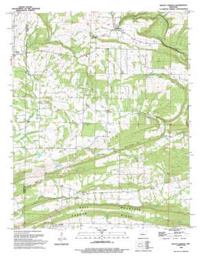
Mount Vernon Topo Map Arkansas
To zoom in, hover over the map of Mount Vernon
USGS Topo Quad 35092b1 - 1:24,000 scale
| Topo Map Name: | Mount Vernon |
| USGS Topo Quad ID: | 35092b1 |
| Print Size: | ca. 21 1/4" wide x 27" high |
| Southeast Coordinates: | 35.125° N latitude / 92° W longitude |
| Map Center Coordinates: | 35.1875° N latitude / 92.0625° W longitude |
| U.S. State: | AR |
| Filename: | o35092b1.jpg |
| Download Map JPG Image: | Mount Vernon topo map 1:24,000 scale |
| Map Type: | Topographic |
| Topo Series: | 7.5´ |
| Map Scale: | 1:24,000 |
| Source of Map Images: | United States Geological Survey (USGS) |
| Alternate Map Versions: |
Mount Vernon AR 1963, updated 1964 Download PDF Buy paper map Mount Vernon AR 1963, updated 1975 Download PDF Buy paper map Mount Vernon AR 1963, updated 1983 Download PDF Buy paper map Mount Vernon AR 1994, updated 1994 Download PDF Buy paper map Mount Vernon AR 2011 Download PDF Buy paper map Mount Vernon AR 2014 Download PDF Buy paper map |
1:24,000 Topo Quads surrounding Mount Vernon
> Back to 35092a1 at 1:100,000 scale
> Back to 35092a1 at 1:250,000 scale
> Back to U.S. Topo Maps home
Mount Vernon topo map: Gazetteer
Mount Vernon: Cliffs
Tucker Bluff elevation 131m 429′Mount Vernon: Populated Places
El Paso elevation 101m 331′Hammondsville elevation 128m 419′
Mount Vernon elevation 132m 433′
Romance elevation 170m 557′
Mount Vernon: Post Offices
El Paso Post Office elevation 99m 324′Romance Post Office elevation 174m 570′
Mount Vernon: Ridges
Bull Mountain elevation 152m 498′Mount Vernon: Streams
Clifty Creek elevation 128m 419′Little Creek elevation 102m 334′
Powell Branch elevation 132m 433′
Mount Vernon: Summits
Black Jack Mountain elevation 187m 613′Bull Creek Hill elevation 179m 587′
Mount Vernon digital topo map on disk
Buy this Mount Vernon topo map showing relief, roads, GPS coordinates and other geographical features, as a high-resolution digital map file on DVD:


