Menifee Topo Map Arkansas
To zoom in, hover over the map of Menifee
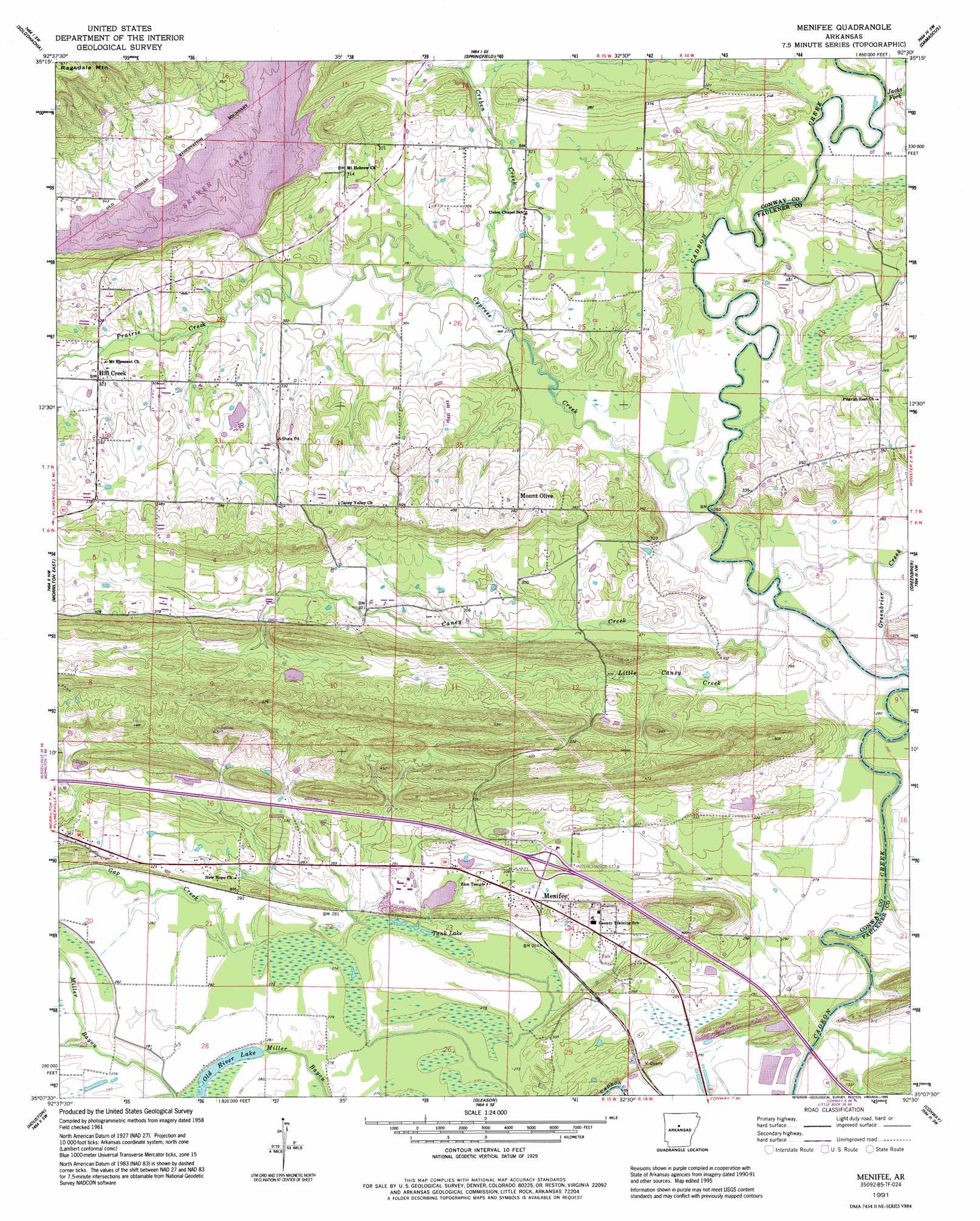
USGS Topo Quad 35092b5 - 1:24,000 scale
| Topo Map Name: | Menifee |
| USGS Topo Quad ID: | 35092b5 |
| Print Size: | ca. 21 1/4" wide x 27" high |
| Southeast Coordinates: | 35.125° N latitude / 92.5° W longitude |
| Map Center Coordinates: | 35.1875° N latitude / 92.5625° W longitude |
| U.S. State: | AR |
| Filename: | o35092b5.jpg |
| Download Map JPG Image: | Menifee topo map 1:24,000 scale |
| Map Type: | Topographic |
| Topo Series: | 7.5´ |
| Map Scale: | 1:24,000 |
| Source of Map Images: | United States Geological Survey (USGS) |
| Alternate Map Versions: |
Menifee AR 1961, updated 1962 Download PDF Buy paper map Menifee AR 1961, updated 1973 Download PDF Buy paper map Menifee AR 1961, updated 1982 Download PDF Buy paper map Menifee AR 1991, updated 1995 Download PDF Buy paper map Menifee AR 2011 Download PDF Buy paper map Menifee AR 2014 Download PDF Buy paper map |
1:24,000 Topo Quads surrounding Menifee
Jerusalem |
Cleveland |
Formosa |
Bee Branch |
Morganton |
Hattieville |
Solgohachia |
Springfield |
Damascus |
Guy |
Morrilton West |
Morrilton East |
Menifee |
Greenbrier |
Holland |
Perryville |
Houston |
Gleason |
Conway |
Hamlet |
Thornburg |
Martindale |
Fourche |
Mayflower |
Cato |
> Back to 35092a1 at 1:100,000 scale
> Back to 35092a1 at 1:250,000 scale
> Back to U.S. Topo Maps home
Menifee topo map: Gazetteer
Menifee: Bridges
Shaw Bridge elevation 82m 269′Menifee: Crossings
Interchange 117 elevation 92m 301′Slaty Ford elevation 78m 255′
Menifee: Dams
Arkansas Noname 24 Dam elevation 87m 285′Menifee: Lakes
Old River Lake elevation 85m 278′Tank Lake elevation 81m 265′
Menifee: Populated Places
Clebb (historical) elevation 84m 275′Hill Creek elevation 98m 321′
Menifee elevation 91m 298′
Mount Olive elevation 117m 383′
Menifee: Streams
Caney Creek elevation 79m 259′Creben Creek elevation 85m 278′
Cypress Creek elevation 80m 262′
Gap Creek elevation 81m 265′
Greenbrier Creek elevation 80m 262′
Hill Creek elevation 106m 347′
Jacks Fork elevation 86m 282′
Little Caney Creek elevation 80m 262′
Prairie Creek elevation 86m 282′
Tupelo Creek elevation 79m 259′
Menifee digital topo map on disk
Buy this Menifee topo map showing relief, roads, GPS coordinates and other geographical features, as a high-resolution digital map file on DVD: