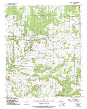
Rose Bud Topo Map Arkansas
To zoom in, hover over the map of Rose Bud
USGS Topo Quad 35092c1 - 1:24,000 scale
| Topo Map Name: | Rose Bud |
| USGS Topo Quad ID: | 35092c1 |
| Print Size: | ca. 21 1/4" wide x 27" high |
| Southeast Coordinates: | 35.25° N latitude / 92° W longitude |
| Map Center Coordinates: | 35.3125° N latitude / 92.0625° W longitude |
| U.S. State: | AR |
| Filename: | o35092c1.jpg |
| Download Map JPG Image: | Rose Bud topo map 1:24,000 scale |
| Map Type: | Topographic |
| Topo Series: | 7.5´ |
| Map Scale: | 1:24,000 |
| Source of Map Images: | United States Geological Survey (USGS) |
| Alternate Map Versions: |
Rose Bud AR 1963, updated 1964 Download PDF Buy paper map Rose Bud AR 1963, updated 1981 Download PDF Buy paper map Rose Bud AR 1994, updated 1994 Download PDF Buy paper map Rose Bud AR 2011 Download PDF Buy paper map Rose Bud AR 2014 Download PDF Buy paper map |
1:24,000 Topo Quads surrounding Rose Bud
> Back to 35092a1 at 1:100,000 scale
> Back to 35092a1 at 1:250,000 scale
> Back to U.S. Topo Maps home
Rose Bud topo map: Gazetteer
Rose Bud: Dams
Arkansas Noname 23 Dam elevation 190m 623′Wingert Lake Dam elevation 204m 669′
Rose Bud: Populated Places
Hart elevation 222m 728′Rose Bud elevation 194m 636′
Turnip (historical) elevation 239m 784′
Rose Bud: Reservoirs
Wingert Reservoir elevation 204m 669′Rose Bud: Streams
Bad Luck Creek elevation 127m 416′Blakey Branch elevation 181m 593′
Boyd Branch elevation 200m 656′
Cedar Creek elevation 160m 524′
Cedar Creek elevation 141m 462′
Clay Branch elevation 171m 561′
Daniels Creek elevation 144m 472′
Graham Branch elevation 193m 633′
Jones Creek elevation 190m 623′
Piney Creek elevation 187m 613′
Potter Branch elevation 161m 528′
Spring Branch elevation 214m 702′
Walnut Creek elevation 168m 551′
Rose Bud: Summits
Blue Hill elevation 237m 777′Bluff Mountain elevation 212m 695′
Gin Mountain elevation 226m 741′
Holman Mountain elevation 235m 770′
Mosely Mountain elevation 206m 675′
Potter Hill elevation 243m 797′
Schoolhouse Hill elevation 260m 853′
Starkey Hill elevation 255m 836′
Starkey Mountain elevation 241m 790′
Wortham Hill elevation 258m 846′
Rose Bud: Valleys
Dripping Springs Hollow elevation 125m 410′Starkey Hollow elevation 177m 580′
Rose Bud digital topo map on disk
Buy this Rose Bud topo map showing relief, roads, GPS coordinates and other geographical features, as a high-resolution digital map file on DVD:


