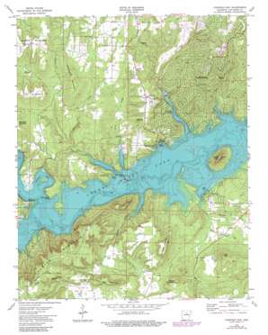
Fairfield Bay Topo Map Arkansas
To zoom in, hover over the map of Fairfield Bay
USGS Topo Quad 35092e3 - 1:24,000 scale
| Topo Map Name: | Fairfield Bay |
| USGS Topo Quad ID: | 35092e3 |
| Print Size: | ca. 21 1/4" wide x 27" high |
| Southeast Coordinates: | 35.5° N latitude / 92.25° W longitude |
| Map Center Coordinates: | 35.5625° N latitude / 92.3125° W longitude |
| U.S. State: | AR |
| Filename: | o35092e3.jpg |
| Download Map JPG Image: | Fairfield Bay topo map 1:24,000 scale |
| Map Type: | Topographic |
| Topo Series: | 7.5´ |
| Map Scale: | 1:24,000 |
| Source of Map Images: | United States Geological Survey (USGS) |
| Alternate Map Versions: |
Fairfield Bay AR 1973 Download PDF Buy paper map Fairfield Bay AR 1973, updated 1982 Download PDF Buy paper map Fairfield Bay AR 1973, updated 1982 Download PDF Buy paper map Fairfield Bay AR 2011 Download PDF Buy paper map Fairfield Bay AR 2014 Download PDF Buy paper map |
1:24,000 Topo Quads surrounding Fairfield Bay
> Back to 35092e1 at 1:100,000 scale
> Back to 35092a1 at 1:250,000 scale
> Back to U.S. Topo Maps home
Fairfield Bay topo map: Gazetteer
Fairfield Bay: Bays
Harpers Cove elevation 137m 449′Fairfield Bay: Capes
Peter Rock Point elevation 156m 511′Stevens Point elevation 304m 997′
Fairfield Bay: Islands
Boat Ridge Island elevation 138m 452′Fairfield Bay: Parks
Sugar Loaf Recreation Area elevation 152m 498′Van Buren Recreation Area elevation 145m 475′
Fairfield Bay: Pillars
Williams Rocks elevation 220m 721′Fairfield Bay: Populated Places
Bloomington (historical) elevation 152m 498′Choctaw Pines elevation 330m 1082′
Eglantine elevation 260m 853′
Fairfield Bay elevation 267m 875′
Palisades elevation 314m 1030′
Fairfield Bay: Streams
Choctaw Creek elevation 136m 446′Dave Creek elevation 137m 449′
Green Creek elevation 137m 449′
Lazy Creek elevation 138m 452′
Lynn Creek elevation 137m 449′
Moccasin Branch elevation 152m 498′
Thompson Creek elevation 137m 449′
Wild Goose Branch elevation 184m 603′
Fairfield Bay: Summits
Banner Mountain elevation 318m 1043′Dougherty Mountain elevation 307m 1007′
High Top elevation 295m 967′
Hunter Mountain elevation 360m 1181′
Lewallen Mountain elevation 319m 1046′
Low Gap Mountain elevation 307m 1007′
Sugar Loaf Mountain elevation 304m 997′
Wright Mountain elevation 256m 839′
Fairfield Bay: Valleys
Bailey Hollow elevation 137m 449′Hooten Hollow elevation 136m 446′
Fairfield Bay digital topo map on disk
Buy this Fairfield Bay topo map showing relief, roads, GPS coordinates and other geographical features, as a high-resolution digital map file on DVD:


