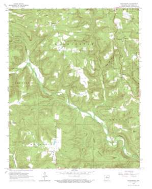
Botkinburg Topo Map Arkansas
To zoom in, hover over the map of Botkinburg
USGS Topo Quad 35092f5 - 1:24,000 scale
| Topo Map Name: | Botkinburg |
| USGS Topo Quad ID: | 35092f5 |
| Print Size: | ca. 21 1/4" wide x 27" high |
| Southeast Coordinates: | 35.625° N latitude / 92.5° W longitude |
| Map Center Coordinates: | 35.6875° N latitude / 92.5625° W longitude |
| U.S. State: | AR |
| Filename: | o35092f5.jpg |
| Download Map JPG Image: | Botkinburg topo map 1:24,000 scale |
| Map Type: | Topographic |
| Topo Series: | 7.5´ |
| Map Scale: | 1:24,000 |
| Source of Map Images: | United States Geological Survey (USGS) |
| Alternate Map Versions: |
Botkinburg AR 1965, updated 1966 Download PDF Buy paper map Botkinburg AR 1965, updated 1973 Download PDF Buy paper map Botkinburg AR 1976, updated 1977 Download PDF Buy paper map Botkinburg AR 2011 Download PDF Buy paper map Botkinburg AR 2014 Download PDF Buy paper map |
1:24,000 Topo Quads surrounding Botkinburg
> Back to 35092e1 at 1:100,000 scale
> Back to 35092a1 at 1:250,000 scale
> Back to U.S. Topo Maps home
Botkinburg topo map: Gazetteer
Botkinburg: Dams
Jackson Lake Dam elevation 443m 1453′Botkinburg: Populated Places
Archey (historical) elevation 210m 688′Botkinburg elevation 403m 1322′
Rocky Hill elevation 441m 1446′
Botkinburg: Reservoirs
Jackson Lake elevation 443m 1453′Botkinburg: Ridges
Chinkapin Ridge elevation 370m 1213′Botkinburg: Streams
Akins Creek elevation 210m 688′Boyce Creek elevation 197m 646′
Castleberry Creek elevation 230m 754′
Hartsugg Creek elevation 196m 643′
Hurricane Branch elevation 171m 561′
North Castleberry Creek elevation 253m 830′
South Castleberry Creek elevation 256m 839′
Botkinburg: Summits
Copper Spring Mountain elevation 447m 1466′Coppers Knob elevation 463m 1519′
Red Hill elevation 558m 1830′
Rocky Hill elevation 441m 1446′
Walnut Knob elevation 466m 1528′
Botkinburg: Valleys
George Main Hollow elevation 249m 816′Zack Hollow elevation 275m 902′
Botkinburg digital topo map on disk
Buy this Botkinburg topo map showing relief, roads, GPS coordinates and other geographical features, as a high-resolution digital map file on DVD:


