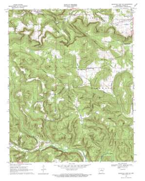
Mountain View Sw Topo Map Arkansas
To zoom in, hover over the map of Mountain View Sw
USGS Topo Quad 35092g2 - 1:24,000 scale
| Topo Map Name: | Mountain View Sw |
| USGS Topo Quad ID: | 35092g2 |
| Print Size: | ca. 21 1/4" wide x 27" high |
| Southeast Coordinates: | 35.75° N latitude / 92.125° W longitude |
| Map Center Coordinates: | 35.8125° N latitude / 92.1875° W longitude |
| U.S. State: | AR |
| Filename: | o35092g2.jpg |
| Download Map JPG Image: | Mountain View Sw topo map 1:24,000 scale |
| Map Type: | Topographic |
| Topo Series: | 7.5´ |
| Map Scale: | 1:24,000 |
| Source of Map Images: | United States Geological Survey (USGS) |
| Alternate Map Versions: |
Mountain View SW AR 1969, updated 1971 Download PDF Buy paper map Mountain View SW AR 2011 Download PDF Buy paper map Mountain View SW AR 2014 Download PDF Buy paper map |
1:24,000 Topo Quads surrounding Mountain View Sw
> Back to 35092e1 at 1:100,000 scale
> Back to 35092a1 at 1:250,000 scale
> Back to U.S. Topo Maps home
Mountain View Sw topo map: Gazetteer
Mountain View Sw: Populated Places
East Richwoods elevation 373m 1223′Turkey Creek elevation 283m 928′
West Richwoods elevation 314m 1030′
Mountain View Sw: Ridges
Cantrel Ridge elevation 235m 770′Halapane Ridge elevation 370m 1213′
Keilhorn Ridge elevation 367m 1204′
Murphy Ridge elevation 371m 1217′
Taylor Ridge elevation 432m 1417′
Mountain View Sw: Streams
Bean Creek elevation 288m 944′Black Branch elevation 202m 662′
Brushy Creek elevation 269m 882′
Cave Spring Branch elevation 285m 935′
Goodson Branch elevation 288m 944′
Hughes Creek elevation 155m 508′
Johnson Creek elevation 253m 830′
Lick Fork elevation 277m 908′
Sams Creek elevation 269m 882′
Mountain View Sw: Summits
Ashlock Hill elevation 384m 1259′Bancroft Hill elevation 429m 1407′
Collins Hill elevation 404m 1325′
Cow Mountain elevation 377m 1236′
Fife Hill elevation 389m 1276′
Finch Mountain elevation 434m 1423′
Fredonia Hill elevation 366m 1200′
Glen Hill elevation 428m 1404′
Hawkins Hill elevation 438m 1437′
Indian Knob elevation 241m 790′
Lost Mountain elevation 438m 1437′
Sugar Hill elevation 451m 1479′
Wade Hill elevation 379m 1243′
Mountain View Sw: Valleys
Benton Hollow elevation 280m 918′Berry Hollow elevation 299m 980′
Brown Camp Hollow elevation 335m 1099′
Bull Pen Hollow elevation 181m 593′
Caney Hollow elevation 310m 1017′
Carr Hollow elevation 206m 675′
Cave Hollow elevation 286m 938′
Cave Spring Hollow elevation 270m 885′
Coal Hollow elevation 242m 793′
Dug Hill Hollow elevation 296m 971′
Dunham Hollow elevation 265m 869′
Gardner Hollow elevation 262m 859′
Goodson Hollow elevation 288m 944′
Green Hollow elevation 252m 826′
Hairpin Hollow elevation 282m 925′
Lick Hollow elevation 241m 790′
Long Branch Hollow elevation 232m 761′
Looney Hollow elevation 187m 613′
McGee Hollow elevation 315m 1033′
Murphy Hollow elevation 175m 574′
Pelahan Hollow elevation 314m 1030′
Price Hollow elevation 194m 636′
Shannon Hollow elevation 187m 613′
Shaw Hollow elevation 301m 987′
Squirrel Hollow elevation 308m 1010′
Vivian Hollow elevation 314m 1030′
Wade Hollow elevation 261m 856′
Wildcat Hollow elevation 257m 843′
Mountain View Sw digital topo map on disk
Buy this Mountain View Sw topo map showing relief, roads, GPS coordinates and other geographical features, as a high-resolution digital map file on DVD:


