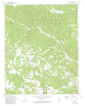
Onia Topo Map Arkansas
To zoom in, hover over the map of Onia
USGS Topo Quad 35092h3 - 1:24,000 scale
| Topo Map Name: | Onia |
| USGS Topo Quad ID: | 35092h3 |
| Print Size: | ca. 21 1/4" wide x 27" high |
| Southeast Coordinates: | 35.875° N latitude / 92.25° W longitude |
| Map Center Coordinates: | 35.9375° N latitude / 92.3125° W longitude |
| U.S. State: | AR |
| Filename: | o35092h3.jpg |
| Download Map JPG Image: | Onia topo map 1:24,000 scale |
| Map Type: | Topographic |
| Topo Series: | 7.5´ |
| Map Scale: | 1:24,000 |
| Source of Map Images: | United States Geological Survey (USGS) |
| Alternate Map Versions: |
Onia AR 1972, updated 1973 Download PDF Buy paper map Onia AR 1972, updated 1982 Download PDF Buy paper map Onia AR 2011 Download PDF Buy paper map Onia AR 2014 Download PDF Buy paper map |
| FStopo: | US Forest Service topo Onia is available: Download FStopo PDF Download FStopo TIF |
1:24,000 Topo Quads surrounding Onia
> Back to 35092e1 at 1:100,000 scale
> Back to 35092a1 at 1:250,000 scale
> Back to U.S. Topo Maps home
Onia topo map: Gazetteer
Onia: Populated Places
Alco elevation 333m 1092′Newnata elevation 182m 597′
Oga (historical) elevation 176m 577′
Onia elevation 221m 725′
Pleasant Hill elevation 285m 935′
Onia: Post Offices
Alco Post Office elevation 331m 1085′Newnata Post Office (historical) elevation 181m 593′
Onia Post Office elevation 230m 754′
Onia: Springs
Big Spring elevation 165m 541′Big Springs elevation 172m 564′
Big Springs elevation 168m 551′
Brewer Spring elevation 164m 538′
Onia: Streams
Bear Pen Creek elevation 174m 570′Carney Creek elevation 185m 606′
Hickory Grove Creek elevation 218m 715′
Mill Creek elevation 162m 531′
South Prong Roasting Ear Creek elevation 245m 803′
West Dry Creek elevation 177m 580′
Onia: Summits
Panther Mountain elevation 440m 1443′Ramsey Knob elevation 331m 1085′
Roper Mountain elevation 495m 1624′
Onia: Valleys
Boardtree Hollow elevation 211m 692′Murry Treat Hollow elevation 225m 738′
Sugar Hollow elevation 223m 731′
Onia digital topo map on disk
Buy this Onia topo map showing relief, roads, GPS coordinates and other geographical features, as a high-resolution digital map file on DVD:


