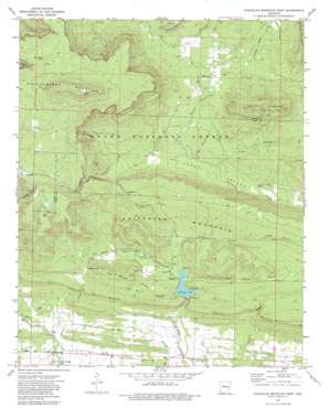
Chickalah Mountain West Topo Map Arkansas
To zoom in, hover over the map of Chickalah Mountain West
USGS Topo Quad 35093b4 - 1:24,000 scale
| Topo Map Name: | Chickalah Mountain West |
| USGS Topo Quad ID: | 35093b4 |
| Print Size: | ca. 21 1/4" wide x 27" high |
| Southeast Coordinates: | 35.125° N latitude / 93.375° W longitude |
| Map Center Coordinates: | 35.1875° N latitude / 93.4375° W longitude |
| U.S. State: | AR |
| Filename: | o35093b4.jpg |
| Download Map JPG Image: | Chickalah Mountain West topo map 1:24,000 scale |
| Map Type: | Topographic |
| Topo Series: | 7.5´ |
| Map Scale: | 1:24,000 |
| Source of Map Images: | United States Geological Survey (USGS) |
| Alternate Map Versions: |
Chickalah Mountain West AR 1972, updated 1974 Download PDF Buy paper map Chickalah Mountain West AR 1972, updated 1982 Download PDF Buy paper map Chickalah Mountain West AR 2011 Download PDF Buy paper map Chickalah Mountain West AR 2014 Download PDF Buy paper map |
| FStopo: | US Forest Service topo Chickalah Mountain West is available: Download FStopo PDF Download FStopo TIF |
1:24,000 Topo Quads surrounding Chickalah Mountain West
> Back to 35093a1 at 1:100,000 scale
> Back to 35092a1 at 1:250,000 scale
> Back to U.S. Topo Maps home
Chickalah Mountain West topo map: Gazetteer
Chickalah Mountain West: Airports
Cedar Creek Ranch Airport elevation 141m 462′Chickalah Mountain West: Bridges
Spring Lake Bridge elevation 159m 521′Chickalah Mountain West: Capes
High Point elevation 412m 1351′Chickalah Mountain West: Cliffs
North Bluff elevation 218m 715′South Bluff elevation 196m 643′
Chickalah Mountain West: Dams
Spring Lake Dam elevation 158m 518′Chickalah Mountain West: Parks
Spring Lake Recreation Area elevation 158m 518′Chickalah Mountain West: Populated Places
Crossroads elevation 342m 1122′Gum Tree elevation 231m 757′
Hickory Grove elevation 227m 744′
Shady Grove elevation 225m 738′
Stafford elevation 161m 528′
Chickalah Mountain West: Reservoirs
Spring Lake elevation 158m 518′Chickalah Mountain West: Ridges
Jim White Ridge elevation 251m 823′Chickalah Mountain West: Springs
Bear Waller Spring elevation 448m 1469′Chickalah Mountain West: Streams
Bob Barnes Branch elevation 153m 501′Box Spring Branch elevation 154m 505′
Dooley Branch elevation 165m 541′
Earles Branch elevation 214m 702′
Horn Branch elevation 147m 482′
Long Branch elevation 148m 485′
Martin Creek elevation 125m 410′
Snake Branch elevation 221m 725′
Tucker Branch elevation 150m 492′
White Creek elevation 155m 508′
Chickalah Mountain West: Summits
Carter Mountain elevation 342m 1122′Chickalah Mountain elevation 271m 889′
Huckleberry Mountain elevation 597m 1958′
Three Knobs elevation 378m 1240′
Chickalah Mountain West: Valleys
Titus Hollow elevation 172m 564′Chickalah Mountain West digital topo map on disk
Buy this Chickalah Mountain West topo map showing relief, roads, GPS coordinates and other geographical features, as a high-resolution digital map file on DVD:


