Magazine Topo Map Arkansas
To zoom in, hover over the map of Magazine
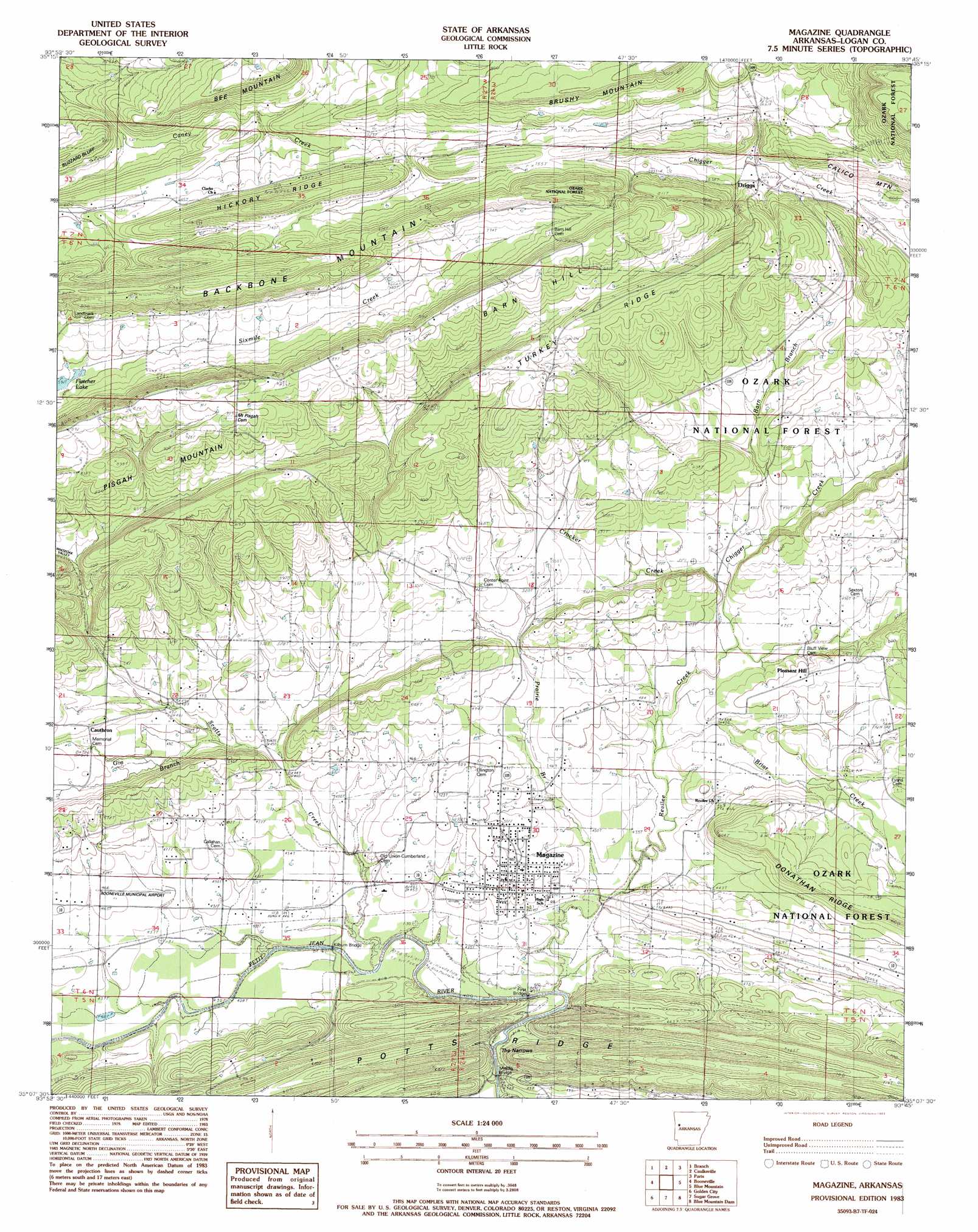
USGS Topo Quad 35093b7 - 1:24,000 scale
| Topo Map Name: | Magazine |
| USGS Topo Quad ID: | 35093b7 |
| Print Size: | ca. 21 1/4" wide x 27" high |
| Southeast Coordinates: | 35.125° N latitude / 93.75° W longitude |
| Map Center Coordinates: | 35.1875° N latitude / 93.8125° W longitude |
| U.S. State: | AR |
| Filename: | o35093b7.jpg |
| Download Map JPG Image: | Magazine topo map 1:24,000 scale |
| Map Type: | Topographic |
| Topo Series: | 7.5´ |
| Map Scale: | 1:24,000 |
| Source of Map Images: | United States Geological Survey (USGS) |
| Alternate Map Versions: |
Magazine AR 1983, updated 1983 Download PDF Buy paper map Magazine AR 2011 Download PDF Buy paper map Magazine AR 2014 Download PDF Buy paper map |
| FStopo: | US Forest Service topo Magazine is available: Download FStopo PDF Download FStopo TIF |
1:24,000 Topo Quads surrounding Magazine
Mulberry |
Cecil |
Ozark |
Coal Hill |
Hartman |
Charleston |
Branch |
Caulksville |
Paris |
Scranton |
Barber |
Booneville |
Magazine |
Blue Mountain |
Magazine Mountain Ne |
Ione |
Golden City |
Sugar Grove |
Blue Mountain Dam |
Havana |
Waldron |
Bee Mountain |
Freedom Mountain |
Gravelly |
Bluffton |
> Back to 35093a1 at 1:100,000 scale
> Back to 35092a1 at 1:250,000 scale
> Back to U.S. Topo Maps home
Magazine topo map: Gazetteer
Magazine: Airports
Booneville Municipal Airport elevation 139m 456′Wesson-Davis Field elevation 166m 544′
Magazine: Bridges
First Bridge elevation 125m 410′Kilburn Bridge elevation 125m 410′
Middle Bridge elevation 125m 410′
Magazine: Gaps
The Narrows elevation 119m 390′Magazine: Lakes
Fletcher Lake elevation 179m 587′Magazine: Oilfields
Magazine Gas Field elevation 211m 692′Magazine: Populated Places
Cauthron elevation 173m 567′Driggs elevation 184m 603′
Magazine elevation 149m 488′
Pleasant Hill elevation 161m 528′
Revilee elevation 142m 465′
Magazine: Ridges
Hickory Ridge elevation 264m 866′Turkey Ridge elevation 254m 833′
Magazine: Streams
Briar Creek elevation 128m 419′Chigger Creek elevation 153m 501′
Crocker Creek elevation 138m 452′
Fletcher Branch elevation 136m 446′
Gin Branch elevation 140m 459′
Prairie Branch elevation 125m 410′
Revilee Creek elevation 127m 416′
Scotts Creek elevation 125m 410′
Magazine: Summits
Backbone Mountain elevation 294m 964′Barn Hill elevation 277m 908′
Bee Mountain elevation 270m 885′
Pisgah Mountain elevation 277m 908′
Magazine: Valleys
Whiteoak Valley elevation 186m 610′Magazine digital topo map on disk
Buy this Magazine topo map showing relief, roads, GPS coordinates and other geographical features, as a high-resolution digital map file on DVD: