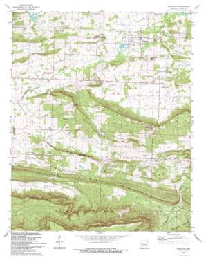
Scranton Topo Map Arkansas
To zoom in, hover over the map of Scranton
USGS Topo Quad 35093c5 - 1:24,000 scale
| Topo Map Name: | Scranton |
| USGS Topo Quad ID: | 35093c5 |
| Print Size: | ca. 21 1/4" wide x 27" high |
| Southeast Coordinates: | 35.25° N latitude / 93.5° W longitude |
| Map Center Coordinates: | 35.3125° N latitude / 93.5625° W longitude |
| U.S. State: | AR |
| Filename: | o35093c5.jpg |
| Download Map JPG Image: | Scranton topo map 1:24,000 scale |
| Map Type: | Topographic |
| Topo Series: | 7.5´ |
| Map Scale: | 1:24,000 |
| Source of Map Images: | United States Geological Survey (USGS) |
| Alternate Map Versions: |
Scranton AR 1961, updated 1962 Download PDF Buy paper map Scranton AR 1961, updated 1965 Download PDF Buy paper map Scranton AR 1961, updated 1989 Download PDF Buy paper map Scranton AR 1993, updated 1993 Download PDF Buy paper map Scranton AR 2011 Download PDF Buy paper map Scranton AR 2014 Download PDF Buy paper map |
| FStopo: | US Forest Service topo Scranton is available: Download FStopo PDF Download FStopo TIF |
1:24,000 Topo Quads surrounding Scranton
> Back to 35093a1 at 1:100,000 scale
> Back to 35092a1 at 1:250,000 scale
> Back to U.S. Topo Maps home
Scranton topo map: Gazetteer
Scranton: Dams
Owens Lake Dam elevation 136m 446′Scranton: Oilfields
Prairie View Gas Field elevation 147m 482′Scranton: Populated Places
Ellsworth (historical) elevation 164m 538′Midway elevation 143m 469′
Plainview elevation 178m 583′
Pleasant Hill elevation 124m 406′
Prairie View elevation 127m 416′
Sand Ridge elevation 207m 679′
Scranton elevation 113m 370′
Wilkins elevation 128m 419′
Scranton: Reservoirs
Owens Lake elevation 136m 446′Scranton: Ridges
Sand Ridge elevation 204m 669′Scranton: Streams
East Fork Cane Creek elevation 121m 396′South Fork Pee Dee Creek elevation 139m 456′
West Fork Cane Creek elevation 133m 436′
Scranton: Summits
Prairie View Mountain elevation 192m 629′Rich Mountain elevation 508m 1666′
Scranton: Valleys
Saint Louis Valley elevation 171m 561′Sorghum Hollow elevation 150m 492′
Scranton digital topo map on disk
Buy this Scranton topo map showing relief, roads, GPS coordinates and other geographical features, as a high-resolution digital map file on DVD:


