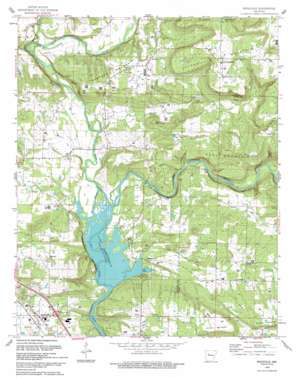
Knoxville Topo Map Arkansas
To zoom in, hover over the map of Knoxville
USGS Topo Quad 35093d3 - 1:24,000 scale
| Topo Map Name: | Knoxville |
| USGS Topo Quad ID: | 35093d3 |
| Print Size: | ca. 21 1/4" wide x 27" high |
| Southeast Coordinates: | 35.375° N latitude / 93.25° W longitude |
| Map Center Coordinates: | 35.4375° N latitude / 93.3125° W longitude |
| U.S. State: | AR |
| Filename: | o35093d3.jpg |
| Download Map JPG Image: | Knoxville topo map 1:24,000 scale |
| Map Type: | Topographic |
| Topo Series: | 7.5´ |
| Map Scale: | 1:24,000 |
| Source of Map Images: | United States Geological Survey (USGS) |
| Alternate Map Versions: |
Knoxville AR 1962, updated 1963 Download PDF Buy paper map Knoxville AR 1962, updated 1975 Download PDF Buy paper map Knoxville AR 1993, updated 1993 Download PDF Buy paper map Knoxville AR 2011 Download PDF Buy paper map Knoxville AR 2014 Download PDF Buy paper map |
1:24,000 Topo Quads surrounding Knoxville
> Back to 35093a1 at 1:100,000 scale
> Back to 35092a1 at 1:250,000 scale
> Back to U.S. Topo Maps home
Knoxville topo map: Gazetteer
Knoxville: Cliffs
Bee Bluff elevation 136m 446′Jackson Bluff elevation 156m 511′
Perry Bluff elevation 153m 501′
Knoxville: Crossings
Interchange 67 elevation 121m 396′Knoxville: Oilfields
Knoxville Gas Field elevation 215m 705′Ross Gas Field elevation 198m 649′
Knoxville: Parks
Piney Bay Recreation Area elevation 106m 347′Knoxville: Populated Places
Garrett elevation 143m 469′Hickeytown elevation 123m 403′
Holman elevation 215m 705′
Knoxville elevation 118m 387′
Lutherville elevation 271m 889′
Pless (historical) elevation 150m 492′
Ross elevation 240m 787′
Knoxville: Streams
Cedar Creek elevation 101m 331′Little Piney Creek elevation 101m 331′
Minnow Creek elevation 118m 387′
Opossum Branch elevation 103m 337′
Slover Creek elevation 105m 344′
Spring Slough elevation 104m 341′
Knoxville: Summits
Colony Mountain elevation 306m 1003′Horton Mountain elevation 263m 862′
Lutherville Mountain elevation 294m 964′
Ross Mountain elevation 276m 905′
Round Mountain elevation 183m 600′
Thompson Mountain elevation 226m 741′
Knoxville digital topo map on disk
Buy this Knoxville topo map showing relief, roads, GPS coordinates and other geographical features, as a high-resolution digital map file on DVD:


