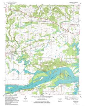
Hartman Topo Map Arkansas
To zoom in, hover over the map of Hartman
USGS Topo Quad 35093d5 - 1:24,000 scale
| Topo Map Name: | Hartman |
| USGS Topo Quad ID: | 35093d5 |
| Print Size: | ca. 21 1/4" wide x 27" high |
| Southeast Coordinates: | 35.375° N latitude / 93.5° W longitude |
| Map Center Coordinates: | 35.4375° N latitude / 93.5625° W longitude |
| U.S. State: | AR |
| Filename: | o35093d5.jpg |
| Download Map JPG Image: | Hartman topo map 1:24,000 scale |
| Map Type: | Topographic |
| Topo Series: | 7.5´ |
| Map Scale: | 1:24,000 |
| Source of Map Images: | United States Geological Survey (USGS) |
| Alternate Map Versions: |
Hartman AR 1961, updated 1962 Download PDF Buy paper map Hartman AR 1961, updated 1973 Download PDF Buy paper map Hartman AR 1961, updated 1982 Download PDF Buy paper map Hartman AR 1993, updated 1993 Download PDF Buy paper map Hartman AR 2011 Download PDF Buy paper map Hartman AR 2014 Download PDF Buy paper map |
1:24,000 Topo Quads surrounding Hartman
> Back to 35093a1 at 1:100,000 scale
> Back to 35092a1 at 1:250,000 scale
> Back to U.S. Topo Maps home
Hartman topo map: Gazetteer
Hartman: Crossings
Interchange 55 elevation 116m 380′Hartman: Islands
Skaggs Island elevation 106m 347′Hartman: Oilfields
Scranton Gas Field elevation 139m 456′Union City Gas Field elevation 161m 528′
Hartman: Parks
Cane Creek Public Use Area elevation 103m 337′Horse Head Public Use Area elevation 100m 328′
Hartman: Populated Places
Bushtown (historical) elevation 121m 396′Hartman elevation 117m 383′
Hinkle elevation 110m 360′
Hoyt elevation 116m 380′
Montana elevation 119m 390′
Morrison Bluff elevation 116m 380′
New Spadra elevation 113m 370′
Shady Grove elevation 121m 396′
Sulphur Springs elevation 148m 485′
Union City elevation 156m 511′
Hartman: Streams
Burt Creek elevation 108m 354′Cane Creek elevation 100m 328′
Hogskin Creek elevation 101m 331′
Horsehead Creek elevation 101m 331′
Sixmile Creek elevation 102m 334′
Slough Creek elevation 102m 334′
Hartman: Summits
Tick Hill elevation 191m 626′Hartman digital topo map on disk
Buy this Hartman topo map showing relief, roads, GPS coordinates and other geographical features, as a high-resolution digital map file on DVD:


