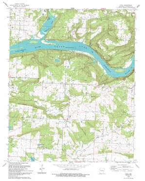
Cecil Topo Map Arkansas
To zoom in, hover over the map of Cecil
USGS Topo Quad 35093d8 - 1:24,000 scale
| Topo Map Name: | Cecil |
| USGS Topo Quad ID: | 35093d8 |
| Print Size: | ca. 21 1/4" wide x 27" high |
| Southeast Coordinates: | 35.375° N latitude / 93.875° W longitude |
| Map Center Coordinates: | 35.4375° N latitude / 93.9375° W longitude |
| U.S. State: | AR |
| Filename: | o35093d8.jpg |
| Download Map JPG Image: | Cecil topo map 1:24,000 scale |
| Map Type: | Topographic |
| Topo Series: | 7.5´ |
| Map Scale: | 1:24,000 |
| Source of Map Images: | United States Geological Survey (USGS) |
| Alternate Map Versions: |
Cecil AR 1965, updated 1967 Download PDF Buy paper map Cecil AR 1965, updated 1983 Download PDF Buy paper map Cecil AR 1993, updated 1993 Download PDF Buy paper map Cecil AR 2011 Download PDF Buy paper map Cecil AR 2014 Download PDF Buy paper map |
1:24,000 Topo Quads surrounding Cecil
> Back to 35093a1 at 1:100,000 scale
> Back to 35092a1 at 1:250,000 scale
> Back to U.S. Topo Maps home
Cecil topo map: Gazetteer
Cecil: Dams
Flanagan Lake Dam elevation 155m 508′Sixmile Creek Site 18 Dam elevation 138m 452′
Sixmile Creek Site 21 Dam elevation 151m 495′
Sixmile Creek Site 22 Dam elevation 134m 439′
Cecil: Oilfields
Cecil Gas Field elevation 221m 725′North Cecil Gas Field elevation 167m 547′
Cecil: Parks
Citadel Bluff Park elevation 125m 410′White Oak Park elevation 143m 469′
Cecil: Populated Places
Cecil elevation 264m 866′Meg elevation 143m 469′
Poping elevation 117m 383′
Sub Rosa (historical) elevation 198m 649′
Cecil: Post Offices
Cecil Post Office elevation 264m 866′Cecil: Reservoirs
Flanagan Lake elevation 155m 508′Lake Number 21 elevation 155m 508′
Lake Number 22 elevation 134m 439′
Sixmile Creek Site 18 Reservoir elevation 138m 452′
Sixmile Creek Site 21 Reservoir elevation 151m 495′
Sixmile Creek Site 22 Reservoir elevation 134m 439′
Cecil: Streams
White Oak Creek elevation 111m 364′Cecil: Summits
Mill Creek Mountain elevation 260m 853′Cecil: Valleys
Pine Hollow elevation 154m 505′Cecil digital topo map on disk
Buy this Cecil topo map showing relief, roads, GPS coordinates and other geographical features, as a high-resolution digital map file on DVD:


