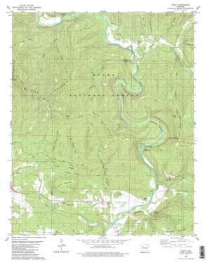
Treat Topo Map Arkansas
To zoom in, hover over the map of Treat
USGS Topo Quad 35093e2 - 1:24,000 scale
| Topo Map Name: | Treat |
| USGS Topo Quad ID: | 35093e2 |
| Print Size: | ca. 21 1/4" wide x 27" high |
| Southeast Coordinates: | 35.5° N latitude / 93.125° W longitude |
| Map Center Coordinates: | 35.5625° N latitude / 93.1875° W longitude |
| U.S. State: | AR |
| Filename: | o35093e2.jpg |
| Download Map JPG Image: | Treat topo map 1:24,000 scale |
| Map Type: | Topographic |
| Topo Series: | 7.5´ |
| Map Scale: | 1:24,000 |
| Source of Map Images: | United States Geological Survey (USGS) |
| Alternate Map Versions: |
Treat AR 1980, updated 1980 Download PDF Buy paper map Treat AR 1980, updated 1980 Download PDF Buy paper map Treat AR 2011 Download PDF Buy paper map Treat AR 2014 Download PDF Buy paper map |
| FStopo: | US Forest Service topo Treat is available: Download FStopo PDF Download FStopo TIF |
1:24,000 Topo Quads surrounding Treat
> Back to 35093e1 at 1:100,000 scale
> Back to 35092a1 at 1:250,000 scale
> Back to U.S. Topo Maps home
Treat topo map: Gazetteer
Treat: Bends
Wainscott Bottom elevation 224m 734′Treat: Capes
Felkins Point elevation 211m 692′Grassy Point elevation 486m 1594′
Treat: Cliffs
Ladd Bluff elevation 218m 715′Ladd Bluff elevation 209m 685′
Treat: Flats
Maupin Flat elevation 193m 633′Wainscott Bottom elevation 198m 649′
Treat: Gaps
Onion Gap elevation 448m 1469′Onion Gap elevation 448m 1469′
The Narrows elevation 395m 1295′
Treat: Oilfields
Silex Gas Field elevation 263m 862′Treat: Parks
Long Pool Recreation Area elevation 165m 541′Treat: Pillars
Pilot Rock elevation 585m 1919′Treat: Populated Places
Bullfrog Valley elevation 204m 669′Silex elevation 278m 912′
Treat elevation 226m 741′
Treat: Ranges
Pilot Rock Mountain elevation 283m 928′Treat: Ridges
Brushy Ridge elevation 270m 885′Brushy Ridge elevation 251m 823′
Treat: Springs
Grimmet Springs elevation 153m 501′Grimmet Springs elevation 151m 495′
Treat: Streams
Big Sawyer Creek elevation 189m 620′Big Sawyer Creek elevation 199m 652′
Dry Branch elevation 153m 501′
Graves Creek elevation 169m 554′
Hole Creek elevation 229m 751′
Indian Creek elevation 179m 587′
Jakes Creek elevation 134m 439′
Levi Branch elevation 142m 465′
Little Sawyer Creek elevation 268m 879′
Little Sawyer Creek elevation 219m 718′
Mill Creek elevation 135m 442′
Moccasin Creek elevation 201m 659′
Spring Creek elevation 187m 613′
Trace Creek elevation 200m 656′
Treat: Summits
Evans Mountain elevation 317m 1040′Evans Mountain elevation 310m 1017′
Felkins Point elevation 217m 711′
Grassy Point elevation 508m 1666′
Newton Hill elevation 454m 1489′
Newton Hill elevation 453m 1486′
Newton Knob elevation 526m 1725′
Tater Knob elevation 186m 610′
Waldo Mountain elevation 474m 1555′
Treat: Trails
Grassy Point Trail elevation 250m 820′Treat: Valleys
Cedar Hollow elevation 186m 610′Cedar Hollow elevation 199m 652′
Elmer Page Hollow elevation 211m 692′
Flat Rock Hollow elevation 199m 652′
Jimmy Hollow elevation 183m 600′
Jimmy Hollow elevation 210m 688′
Little Still Hollow elevation 197m 646′
Mine Hollow elevation 200m 656′
Rough Hollow elevation 143m 469′
Short Hollow elevation 223m 731′
Short Hollow elevation 235m 770′
Treat digital topo map on disk
Buy this Treat topo map showing relief, roads, GPS coordinates and other geographical features, as a high-resolution digital map file on DVD:


