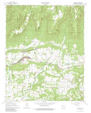
Harmony Topo Map Arkansas
To zoom in, hover over the map of Harmony
USGS Topo Quad 35093e5 - 1:24,000 scale
| Topo Map Name: | Harmony |
| USGS Topo Quad ID: | 35093e5 |
| Print Size: | ca. 21 1/4" wide x 27" high |
| Southeast Coordinates: | 35.5° N latitude / 93.5° W longitude |
| Map Center Coordinates: | 35.5625° N latitude / 93.5625° W longitude |
| U.S. State: | AR |
| Filename: | o35093e5.jpg |
| Download Map JPG Image: | Harmony topo map 1:24,000 scale |
| Map Type: | Topographic |
| Topo Series: | 7.5´ |
| Map Scale: | 1:24,000 |
| Source of Map Images: | United States Geological Survey (USGS) |
| Alternate Map Versions: |
Harmony AR 1963, updated 1964 Download PDF Buy paper map Harmony AR 1963, updated 1981 Download PDF Buy paper map Harmony AR 2011 Download PDF Buy paper map Harmony AR 2014 Download PDF Buy paper map |
| FStopo: | US Forest Service topo Harmony is available: Download FStopo PDF Download FStopo TIF |
1:24,000 Topo Quads surrounding Harmony
> Back to 35093e1 at 1:100,000 scale
> Back to 35092a1 at 1:250,000 scale
> Back to U.S. Topo Maps home
Harmony topo map: Gazetteer
Harmony: Airports
Johnson Farm Lines Airport elevation 232m 761′Harmony: Capes
Crawford Point elevation 476m 1561′Harmony: Gaps
Yarbough Gap elevation 550m 1804′Harmony: Oilfields
Clarksville Gas Field elevation 222m 728′Linville Gas Field elevation 270m 885′
Harmony: Populated Places
Dale (historical) elevation 630m 2066′Harmony elevation 188m 616′
Lone Pine elevation 197m 646′
Woodland elevation 243m 797′
Harmony: Ridges
Chinquapin Ridge elevation 577m 1893′Grass Ridge elevation 633m 2076′
McConnell Ridge elevation 599m 1965′
Harmony: Streams
Cole Creek elevation 182m 597′Cove Creek elevation 167m 547′
Harmony: Summits
Stillwell Mountain elevation 252m 826′Harmony digital topo map on disk
Buy this Harmony topo map showing relief, roads, GPS coordinates and other geographical features, as a high-resolution digital map file on DVD:


