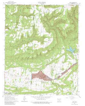
Hunt Topo Map Arkansas
To zoom in, hover over the map of Hunt
USGS Topo Quad 35093e6 - 1:24,000 scale
| Topo Map Name: | Hunt |
| USGS Topo Quad ID: | 35093e6 |
| Print Size: | ca. 21 1/4" wide x 27" high |
| Southeast Coordinates: | 35.5° N latitude / 93.625° W longitude |
| Map Center Coordinates: | 35.5625° N latitude / 93.6875° W longitude |
| U.S. State: | AR |
| Filename: | o35093e6.jpg |
| Download Map JPG Image: | Hunt topo map 1:24,000 scale |
| Map Type: | Topographic |
| Topo Series: | 7.5´ |
| Map Scale: | 1:24,000 |
| Source of Map Images: | United States Geological Survey (USGS) |
| Alternate Map Versions: |
Hunt AR 1963, updated 1964 Download PDF Buy paper map Hunt AR 1963, updated 1981 Download PDF Buy paper map Hunt AR 2011 Download PDF Buy paper map Hunt AR 2014 Download PDF Buy paper map |
| FStopo: | US Forest Service topo Hunt is available: Download FStopo PDF Download FStopo TIF |
1:24,000 Topo Quads surrounding Hunt
> Back to 35093e1 at 1:100,000 scale
> Back to 35092a1 at 1:250,000 scale
> Back to U.S. Topo Maps home
Hunt topo map: Gazetteer
Hunt: Dams
Horsehead Lake Dam elevation 201m 659′Hunt: Mines
Utah Strip Mine elevation 193m 633′Hunt: Parks
Horsehead Lake Recreation Area elevation 211m 692′Hunt: Populated Places
Batson elevation 593m 1945′Edna elevation 188m 616′
Hunt elevation 186m 610′
Linville (historical) elevation 551m 1807′
Mountain Top elevation 491m 1610′
Oak Grove elevation 546m 1791′
Smeadley (historical) elevation 136m 446′
White Oak elevation 547m 1794′
Hunt: Post Offices
Hunt Post Office elevation 190m 623′Hunt: Reservoirs
Horsehead Lake elevation 201m 659′Hunt: Streams
West Fork Horsehead Creek elevation 207m 679′Hunt: Summits
Younger Knob elevation 582m 1909′Hunt: Valleys
Philpott Valley elevation 180m 590′Hunt digital topo map on disk
Buy this Hunt topo map showing relief, roads, GPS coordinates and other geographical features, as a high-resolution digital map file on DVD:


