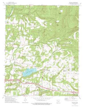
Watalula Topo Map Arkansas
To zoom in, hover over the map of Watalula
USGS Topo Quad 35093e7 - 1:24,000 scale
| Topo Map Name: | Watalula |
| USGS Topo Quad ID: | 35093e7 |
| Print Size: | ca. 21 1/4" wide x 27" high |
| Southeast Coordinates: | 35.5° N latitude / 93.75° W longitude |
| Map Center Coordinates: | 35.5625° N latitude / 93.8125° W longitude |
| U.S. State: | AR |
| Filename: | o35093e7.jpg |
| Download Map JPG Image: | Watalula topo map 1:24,000 scale |
| Map Type: | Topographic |
| Topo Series: | 7.5´ |
| Map Scale: | 1:24,000 |
| Source of Map Images: | United States Geological Survey (USGS) |
| Alternate Map Versions: |
Watalula AR 1973, updated 1976 Download PDF Buy paper map Watalula AR 1973, updated 1976 Download PDF Buy paper map Watalula AR 2011 Download PDF Buy paper map Watalula AR 2014 Download PDF Buy paper map |
| FStopo: | US Forest Service topo Watalula is available: Download FStopo PDF Download FStopo TIF |
1:24,000 Topo Quads surrounding Watalula
> Back to 35093e1 at 1:100,000 scale
> Back to 35092a1 at 1:250,000 scale
> Back to U.S. Topo Maps home
Watalula topo map: Gazetteer
Watalula: Airports
Ozark Airport elevation 187m 613′Whitman Field elevation 188m 616′
Watalula: Crossings
Interchange 35 elevation 165m 541′Interchange 37 elevation 196m 643′
Interstate 41 elevation 180m 590′
Rock Creek Ford elevation 188m 616′
Watalula: Dams
Ozark Water Supply Lake Dam elevation 183m 600′Watalula: Oilfields
Rock Creek Gas Field elevation 482m 1581′White Oak Gas Field elevation 249m 816′
Watalula: Populated Places
Felkner Town elevation 149m 488′Mountain Grove elevation 224m 734′
Sutherland Crossroads elevation 246m 807′
Watalula elevation 207m 679′
White Oak elevation 148m 485′
Watalula: Reservoirs
Ozark City Lake elevation 183m 600′Watalula: Springs
Battle Springs elevation 515m 1689′Burrell Spring elevation 227m 744′
Watalula: Streams
Cripple Branch elevation 206m 675′Duncan Branch elevation 143m 469′
North Fork White Oak Creek elevation 142m 465′
South Fork White Oak Creek elevation 142m 465′
Watalula: Summits
Carter Mountain elevation 657m 2155′Douglas Mountain elevation 599m 1965′
Mount Ephraim elevation 593m 1945′
Watalula: Valleys
Wildcat Hollow elevation 281m 921′Watalula digital topo map on disk
Buy this Watalula topo map showing relief, roads, GPS coordinates and other geographical features, as a high-resolution digital map file on DVD:


