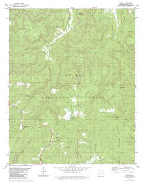
Lurton Topo Map Arkansas
To zoom in, hover over the map of Lurton
USGS Topo Quad 35093g1 - 1:24,000 scale
| Topo Map Name: | Lurton |
| USGS Topo Quad ID: | 35093g1 |
| Print Size: | ca. 21 1/4" wide x 27" high |
| Southeast Coordinates: | 35.75° N latitude / 93° W longitude |
| Map Center Coordinates: | 35.8125° N latitude / 93.0625° W longitude |
| U.S. State: | AR |
| Filename: | o35093g1.jpg |
| Download Map JPG Image: | Lurton topo map 1:24,000 scale |
| Map Type: | Topographic |
| Topo Series: | 7.5´ |
| Map Scale: | 1:24,000 |
| Source of Map Images: | United States Geological Survey (USGS) |
| Alternate Map Versions: |
Mt Judea SE AR 1974, updated 1975 Download PDF Buy paper map Lurton AR 1980, updated 1980 Download PDF Buy paper map Lurton AR 1980, updated 1988 Download PDF Buy paper map Lurton AR 1980, updated 1988 Download PDF Buy paper map Lurton AR 2011 Download PDF Buy paper map Lurton AR 2014 Download PDF Buy paper map |
| FStopo: | US Forest Service topo Lurton is available: Download FStopo PDF Download FStopo TIF |
1:24,000 Topo Quads surrounding Lurton
> Back to 35093e1 at 1:100,000 scale
> Back to 35092a1 at 1:250,000 scale
> Back to U.S. Topo Maps home
Lurton topo map: Gazetteer
Lurton: Cliffs
Sams Throne elevation 384m 1259′Lurton: Flats
Tarlton Flats elevation 636m 2086′Lurton: Populated Places
Holt (historical) elevation 311m 1020′Lurton elevation 611m 2004′
Spence Jucntion elevation 639m 2096′
Lurton: Ranges
George Mountain elevation 633m 2076′Lurton: Ridges
Shulers Point elevation 638m 2093′Lurton: Streams
Battle Creek elevation 351m 1151′Battle Creek elevation 350m 1148′
Campbell Creek elevation 311m 1020′
Cow Creek elevation 319m 1046′
Dan Heffley Branch elevation 364m 1194′
Dan Heffley Branch elevation 362m 1187′
Falls Branch elevation 363m 1190′
Tilly Creek elevation 399m 1309′
Tilly Creek elevation 399m 1309′
Lurton: Summits
Daniel Mountain elevation 663m 2175′Daniel Mountain elevation 665m 2181′
Greenhaw Mountain elevation 580m 1902′
Hudson Mountain elevation 654m 2145′
Ketcherside Mountain elevation 682m 2237′
Ketcherside Mountain elevation 668m 2191′
Middle Mountain elevation 456m 1496′
Middle Mountain elevation 490m 1607′
Sassafras Knob elevation 644m 2112′
Shulers Point elevation 646m 2119′
Lurton: Valleys
Cox Hollow elevation 461m 1512′Greenhaw Hollow elevation 453m 1486′
Greenhaw Hollow elevation 452m 1482′
Rock House Hollow elevation 338m 1108′
Rock House Hollow elevation 327m 1072′
Still Hollow elevation 438m 1437′
Still Hollow elevation 442m 1450′
Lurton digital topo map on disk
Buy this Lurton topo map showing relief, roads, GPS coordinates and other geographical features, as a high-resolution digital map file on DVD:


