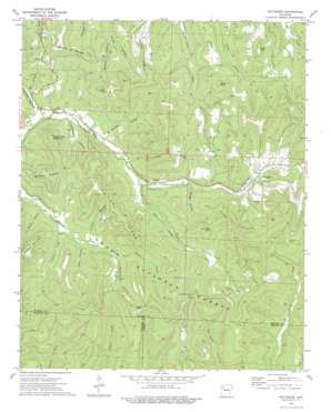
Pettigrew Topo Map Arkansas
To zoom in, hover over the map of Pettigrew
USGS Topo Quad 35093g6 - 1:24,000 scale
| Topo Map Name: | Pettigrew |
| USGS Topo Quad ID: | 35093g6 |
| Print Size: | ca. 21 1/4" wide x 27" high |
| Southeast Coordinates: | 35.75° N latitude / 93.625° W longitude |
| Map Center Coordinates: | 35.8125° N latitude / 93.6875° W longitude |
| U.S. State: | AR |
| Filename: | o35093g6.jpg |
| Download Map JPG Image: | Pettigrew topo map 1:24,000 scale |
| Map Type: | Topographic |
| Topo Series: | 7.5´ |
| Map Scale: | 1:24,000 |
| Source of Map Images: | United States Geological Survey (USGS) |
| Alternate Map Versions: |
Pettigrew AR 1973, updated 1976 Download PDF Buy paper map Pettigrew AR 1973, updated 1976 Download PDF Buy paper map Pettigrew AR 2011 Download PDF Buy paper map Pettigrew AR 2014 Download PDF Buy paper map |
| FStopo: | US Forest Service topo Pettigrew is available: Download FStopo PDF Download FStopo TIF |
1:24,000 Topo Quads surrounding Pettigrew
Goshen |
Hartwell |
Huntsville |
Kingston |
Osage Sw |
Durham |
Japton |
Witter |
Weathers |
Boxley |
Delaney |
Saint Paul |
Pettigrew |
Boston |
Fallsville |
Bidville |
Cass |
Yale |
Oark |
Ozone |
Cravens |
Watalula |
Hunt |
Harmony |
Ludwig |
> Back to 35093e1 at 1:100,000 scale
> Back to 35092a1 at 1:250,000 scale
> Back to U.S. Topo Maps home
Pettigrew topo map: Gazetteer
Pettigrew: Gaps
John White Gap elevation 644m 2112′Kelly Gap elevation 645m 2116′
Kilgore Gap elevation 684m 2244′
Mitchell Gap elevation 625m 2050′
Pettigrew: Populated Places
Dutton elevation 511m 1676′Pettigrew elevation 557m 1827′
Pettigrew: Post Offices
Pettigrew Post Office elevation 557m 1827′Pettigrew: Ridges
Horn Ridge elevation 624m 2047′Sailor Ridge elevation 704m 2309′
Watson Ridge elevation 682m 2237′
Pettigrew: Streams
Abner Branch elevation 530m 1738′East Prong White River elevation 505m 1656′
Gregory Branch elevation 512m 1679′
Kilgore Branch elevation 530m 1738′
Lumpkin Creek elevation 485m 1591′
Snow Branch elevation 508m 1666′
Pettigrew: Summits
Barker Knob elevation 672m 2204′Garrett Mountain elevation 730m 2395′
High Davey Mountain elevation 704m 2309′
Isaac Knob elevation 741m 2431′
Keck Knob elevation 701m 2299′
Pool Knob elevation 676m 2217′
Sugar Tree Mountain elevation 687m 2253′
Whittmore Mountain elevation 656m 2152′
Pettigrew: Valleys
Adkins Hollow elevation 527m 1729′Cooper Hollow elevation 486m 1594′
Hawkins Hollow elevation 477m 1564′
Hooper Hollow elevation 496m 1627′
Morgan Hollow elevation 533m 1748′
Tweedy Hollow elevation 497m 1630′
Wist Hollow elevation 508m 1666′
Pettigrew digital topo map on disk
Buy this Pettigrew topo map showing relief, roads, GPS coordinates and other geographical features, as a high-resolution digital map file on DVD:


