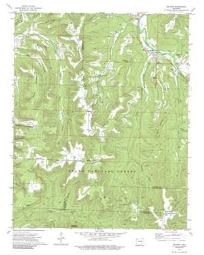
Delaney Topo Map Arkansas
To zoom in, hover over the map of Delaney
USGS Topo Quad 35093g8 - 1:24,000 scale
| Topo Map Name: | Delaney |
| USGS Topo Quad ID: | 35093g8 |
| Print Size: | ca. 21 1/4" wide x 27" high |
| Southeast Coordinates: | 35.75° N latitude / 93.875° W longitude |
| Map Center Coordinates: | 35.8125° N latitude / 93.9375° W longitude |
| U.S. State: | AR |
| Filename: | o35093g8.jpg |
| Download Map JPG Image: | Delaney topo map 1:24,000 scale |
| Map Type: | Topographic |
| Topo Series: | 7.5´ |
| Map Scale: | 1:24,000 |
| Source of Map Images: | United States Geological Survey (USGS) |
| Alternate Map Versions: |
Delaney AR 1973, updated 1976 Download PDF Buy paper map Delaney AR 1973, updated 1989 Download PDF Buy paper map Delaney AR 2011 Download PDF Buy paper map Delaney AR 2014 Download PDF Buy paper map |
| FStopo: | US Forest Service topo Delaney is available: Download FStopo PDF Download FStopo TIF |
1:24,000 Topo Quads surrounding Delaney
> Back to 35093e1 at 1:100,000 scale
> Back to 35092a1 at 1:250,000 scale
> Back to U.S. Topo Maps home
Delaney topo map: Gazetteer
Delaney: Gaps
Wheeler Gap elevation 612m 2007′Delaney: Populated Places
Brannon elevation 698m 2290′Crosses elevation 408m 1338′
Delaney elevation 412m 1351′
Hazel Valley elevation 476m 1561′
Health elevation 733m 2404′
Mountain Crest elevation 723m 2372′
Patrick elevation 413m 1354′
Delaney: Post Offices
Dump Post Office (historical) elevation 692m 2270′Hazel Valley Post Office (historical) elevation 488m 1601′
Delaney: Streams
Crosses Creek elevation 398m 1305′Dabney Creek elevation 407m 1335′
Delaney Creek elevation 401m 1315′
Peach Branch elevation 468m 1535′
Possum Creek elevation 410m 1345′
Sugar Creek elevation 471m 1545′
Delaney: Summits
Anderson Knob elevation 673m 2208′Baker Knob elevation 651m 2135′
Boone Mountain elevation 690m 2263′
Brannon Mountain elevation 699m 2293′
Brown Mountain elevation 645m 2116′
Denny Mountain elevation 718m 2355′
Shepherd Mountain elevation 703m 2306′
Stacy Mountain elevation 686m 2250′
Delaney: Valleys
Canner Hollow elevation 457m 1499′Stringum Hollow elevation 491m 1610′
Walls Hollow elevation 546m 1791′
Delaney digital topo map on disk
Buy this Delaney topo map showing relief, roads, GPS coordinates and other geographical features, as a high-resolution digital map file on DVD:


