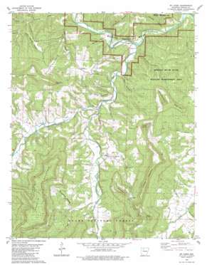
Mount Judea Topo Map Arkansas
To zoom in, hover over the map of Mount Judea
USGS Topo Quad 35093h1 - 1:24,000 scale
| Topo Map Name: | Mount Judea |
| USGS Topo Quad ID: | 35093h1 |
| Print Size: | ca. 21 1/4" wide x 27" high |
| Southeast Coordinates: | 35.875° N latitude / 93° W longitude |
| Map Center Coordinates: | 35.9375° N latitude / 93.0625° W longitude |
| U.S. State: | AR |
| Filename: | o35093h1.jpg |
| Download Map JPG Image: | Mount Judea topo map 1:24,000 scale |
| Map Type: | Topographic |
| Topo Series: | 7.5´ |
| Map Scale: | 1:24,000 |
| Source of Map Images: | United States Geological Survey (USGS) |
| Alternate Map Versions: |
Mt Judea NE AR 1974, updated 1975 Download PDF Buy paper map Mt Judea AR 1980, updated 1981 Download PDF Buy paper map Mt Judea AR 1980, updated 1984 Download PDF Buy paper map Mount Judea AR 2011 Download PDF Buy paper map Mount Judea AR 2014 Download PDF Buy paper map |
| FStopo: | US Forest Service topo Mount Judea is available: Download FStopo PDF Download FStopo TIF |
1:24,000 Topo Quads surrounding Mount Judea
> Back to 35093e1 at 1:100,000 scale
> Back to 35092a1 at 1:250,000 scale
> Back to U.S. Topo Maps home
Mount Judea topo map: Gazetteer
Mount Judea: Capes
Riddle Point elevation 451m 1479′Mount Judea: Cliffs
Red Rock Point elevation 554m 1817′Mount Judea: Gaps
Campbell Gap elevation 521m 1709′Mount Judea: Parks
Buffalo River State Wildlife Management Area elevation 321m 1053′Mount Judea: Populated Places
Carver elevation 271m 889′Mount Judea elevation 279m 915′
Piercetown elevation 339m 1112′
Vendor elevation 236m 774′
Mount Judea: Post Offices
Mount Judea Post Office elevation 274m 898′Vendor Post Office elevation 246m 807′
Mount Judea: Streams
Big Creek elevation 215m 705′Cave Spring Branch elevation 228m 748′
Dry Branch elevation 252m 826′
Dry Branch elevation 232m 761′
Dry Creek elevation 261m 856′
East Fork Cave Creek elevation 273m 895′
Left Fork Big Creek elevation 227m 744′
Lick Creek elevation 220m 721′
Sheldon Branch elevation 224m 734′
Mount Judea: Summits
Dick Knob elevation 598m 1961′Dick Knob elevation 585m 1919′
Kent Mountain elevation 557m 1827′
North Pole Knob elevation 600m 1968′
Ricketts Mountain elevation 591m 1938′
Riddle Point elevation 512m 1679′
Round Mountain elevation 632m 2073′
Mount Judea: Valleys
Deal Hollow elevation 223m 731′Elm Spring Hollow elevation 220m 721′
Hancock Hollow elevation 221m 725′
Jim Brown Hollow elevation 225m 738′
Lime Kiln Hollow elevation 251m 823′
Rough Hollow elevation 288m 944′
Roy Spring Hollow elevation 264m 866′
Stillhouse Hollow elevation 218m 715′
Sycamore Hollow elevation 273m 895′
Youngs Creek elevation 256m 839′
Mount Judea digital topo map on disk
Buy this Mount Judea topo map showing relief, roads, GPS coordinates and other geographical features, as a high-resolution digital map file on DVD:


