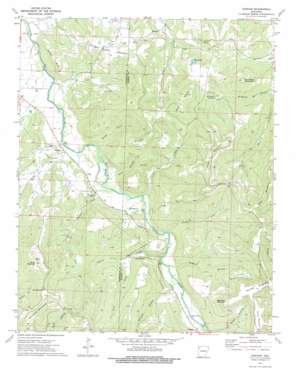
Durham Topo Map Arkansas
To zoom in, hover over the map of Durham
USGS Topo Quad 35093h8 - 1:24,000 scale
| Topo Map Name: | Durham |
| USGS Topo Quad ID: | 35093h8 |
| Print Size: | ca. 21 1/4" wide x 27" high |
| Southeast Coordinates: | 35.875° N latitude / 93.875° W longitude |
| Map Center Coordinates: | 35.9375° N latitude / 93.9375° W longitude |
| U.S. State: | AR |
| Filename: | o35093h8.jpg |
| Download Map JPG Image: | Durham topo map 1:24,000 scale |
| Map Type: | Topographic |
| Topo Series: | 7.5´ |
| Map Scale: | 1:24,000 |
| Source of Map Images: | United States Geological Survey (USGS) |
| Alternate Map Versions: |
Durham AR 1973, updated 1976 Download PDF Buy paper map Durham AR 2011 Download PDF Buy paper map Durham AR 2014 Download PDF Buy paper map |
1:24,000 Topo Quads surrounding Durham
> Back to 35093e1 at 1:100,000 scale
> Back to 35092a1 at 1:250,000 scale
> Back to U.S. Topo Maps home
Durham topo map: Gazetteer
Durham: Cliffs
Shaffer Bluff elevation 462m 1515′Durham: Gaps
Low Gap elevation 605m 1984′Durham: Lakes
Dills Lakes elevation 521m 1709′Durham: Populated Places
Cannon Creek elevation 441m 1446′Durham elevation 380m 1246′
Thompson elevation 407m 1335′
Thorney elevation 401m 1315′
Durham: Post Offices
Durham Post Office (historical) elevation 379m 1243′Durham: Springs
Burchette Spring elevation 463m 1519′Durham: Streams
Cannon Creek elevation 388m 1272′Coon Creek elevation 416m 1364′
Fritts Creek elevation 379m 1243′
George Creek elevation 376m 1233′
Lick Branch elevation 378m 1240′
Panther Creek elevation 388m 1272′
Shumate Creek elevation 376m 1233′
Snake Creek elevation 375m 1230′
Durham: Summits
Bushart Mountain elevation 597m 1958′Chicken Bristle Mountain elevation 499m 1637′
Hammond Mountain elevation 673m 2208′
High Rock Mountain elevation 685m 2247′
Hobbs Mountain elevation 676m 2217′
Lacy Mountain elevation 634m 2080′
Massey Mountain elevation 686m 2250′
McCullah Hill elevation 588m 1929′
Pinnacle Mountain elevation 648m 2125′
Roundtop Mountain elevation 566m 1856′
Durham: Valleys
Blackland Cove elevation 378m 1240′Greens Hollow elevation 399m 1309′
Rocky Hollow elevation 406m 1332′
Skinner Hollow elevation 400m 1312′
Durham digital topo map on disk
Buy this Durham topo map showing relief, roads, GPS coordinates and other geographical features, as a high-resolution digital map file on DVD:


