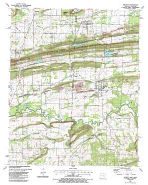
Hackett Topo Map Arkansas
To zoom in, hover over the map of Hackett
USGS Topo Quad 35094b4 - 1:24,000 scale
| Topo Map Name: | Hackett |
| USGS Topo Quad ID: | 35094b4 |
| Print Size: | ca. 21 1/4" wide x 27" high |
| Southeast Coordinates: | 35.125° N latitude / 94.375° W longitude |
| Map Center Coordinates: | 35.1875° N latitude / 94.4375° W longitude |
| U.S. States: | AR, OK |
| Filename: | o35094b4.jpg |
| Download Map JPG Image: | Hackett topo map 1:24,000 scale |
| Map Type: | Topographic |
| Topo Series: | 7.5´ |
| Map Scale: | 1:24,000 |
| Source of Map Images: | United States Geological Survey (USGS) |
| Alternate Map Versions: |
Hackett AR 1948, updated 1963 Download PDF Buy paper map Hackett AR 1948, updated 1975 Download PDF Buy paper map Hackett AR 1948, updated 1978 Download PDF Buy paper map Hackett AR 1951 Download PDF Buy paper map Hackett AR 1987, updated 1988 Download PDF Buy paper map Hackett AR 2011 Download PDF Buy paper map Hackett AR 2014 Download PDF Buy paper map |
1:24,000 Topo Quads surrounding Hackett
> Back to 35094a1 at 1:100,000 scale
> Back to 35094a1 at 1:250,000 scale
> Back to U.S. Topo Maps home
Hackett topo map: Gazetteer
Hackett: Dams
Harden Number 1 Dam elevation 185m 606′Sebastian Lake Dam elevation 182m 597′
Wafford Lake Dam elevation 173m 567′
Hackett: Lakes
Wofford Lake elevation 167m 547′Hackett: Parks
Davy Park elevation 152m 498′Hackett: Populated Places
Bonanza elevation 167m 547′Cedar Knobb elevation 203m 666′
Doubleday (historical) elevation 148m 485′
Hackett elevation 162m 531′
Jenson elevation 163m 534′
Pocola elevation 147m 482′
Rock Island elevation 152m 498′
Hackett: Reservoirs
Harden Number 1 Reservoir elevation 185m 606′Sebastian Lake elevation 182m 597′
Wafford Lake elevation 173m 567′
Wofford Lake elevation 172m 564′
Hackett: Streams
Big Branch elevation 139m 456′Big Branch elevation 144m 472′
Elder Branch elevation 142m 465′
Hackett Creek elevation 159m 521′
Ivy Branch elevation 141m 462′
Hackett: Summits
Cedar Knob elevation 199m 652′Gray Mountain elevation 202m 662′
Gray Mountain elevation 204m 669′
Hackett: Valleys
Bear Hollow elevation 188m 616′Hackett digital topo map on disk
Buy this Hackett topo map showing relief, roads, GPS coordinates and other geographical features, as a high-resolution digital map file on DVD:


