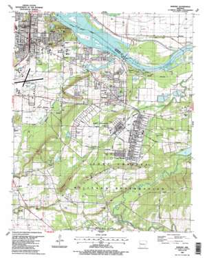
Barling Topo Map Arkansas
To zoom in, hover over the map of Barling
USGS Topo Quad 35094c3 - 1:24,000 scale
| Topo Map Name: | Barling |
| USGS Topo Quad ID: | 35094c3 |
| Print Size: | ca. 21 1/4" wide x 27" high |
| Southeast Coordinates: | 35.25° N latitude / 94.25° W longitude |
| Map Center Coordinates: | 35.3125° N latitude / 94.3125° W longitude |
| U.S. State: | AR |
| Filename: | o35094c3.jpg |
| Download Map JPG Image: | Barling topo map 1:24,000 scale |
| Map Type: | Topographic |
| Topo Series: | 7.5´ |
| Map Scale: | 1:24,000 |
| Source of Map Images: | United States Geological Survey (USGS) |
| Alternate Map Versions: |
Barling AR 1947, updated 1971 Download PDF Buy paper map Barling AR 1947, updated 1978 Download PDF Buy paper map Barling AR 1951 Download PDF Buy paper map Barling AR 1976, updated 1978 Download PDF Buy paper map Barling AR 1987, updated 1988 Download PDF Buy paper map Barling AR 2011 Download PDF Buy paper map Barling AR 2014 Download PDF Buy paper map |
1:24,000 Topo Quads surrounding Barling
> Back to 35094a1 at 1:100,000 scale
> Back to 35094a1 at 1:250,000 scale
> Back to U.S. Topo Maps home
Barling topo map: Gazetteer
Barling: Airports
Fort Chaffee Landing Strip elevation 137m 449′Fort Smith Municipal Airport elevation 134m 439′
Saint Edward Mercy Medical Center Heliport elevation 151m 495′
Barling: Bridges
Jenny Lind Bridge elevation 131m 429′Barling: Crossings
Interchange 8 elevation 161m 528′Barling: Dams
Lock and Dam Number 13 elevation 117m 383′Lock and Dam Number 13 elevation 116m 380′
McMahan Lake Dam elevation 133m 436′
Wildcat Mountain Lake Dam elevation 131m 429′
Willies Lake Dam elevation 150m 492′
Barling: Parks
Ben Geren Regional Park elevation 133m 436′Carol Ann Cross Park elevation 136m 446′
Dam Site North Public Use Area elevation 120m 393′
Dam Site South Public Use Area elevation 120m 393′
West Arkansas Regional Park elevation 130m 426′
Barling: Populated Places
Barling elevation 144m 472′Central City elevation 129m 423′
Crescent elevation 171m 561′
Fort Chaffee elevation 139m 456′
Haroldton elevation 120m 393′
Jenny Lind elevation 143m 469′
Massard elevation 130m 426′
New Jenny Lind elevation 141m 462′
Barling: Post Offices
Barling Post Office elevation 137m 449′Barling Post Office elevation 136m 446′
Barling: Reservoirs
McMahan Lake elevation 133m 436′Pool 13 elevation 116m 380′
Wildcat Mountain Lake elevation 131m 429′
Willies Lake elevation 150m 492′
Barling: Ridges
Donahoe Ridge elevation 172m 564′Spredding Ridge elevation 161m 528′
Barling: Streams
Bear Creek elevation 133m 436′Flat Rock Creek elevation 120m 393′
Grayson Creek elevation 116m 380′
Massard Creek elevation 119m 390′
Prairie Creek elevation 134m 439′
Barling: Summits
Howard Hill elevation 176m 577′Wildcat Mountain elevation 186m 610′
Barling digital topo map on disk
Buy this Barling topo map showing relief, roads, GPS coordinates and other geographical features, as a high-resolution digital map file on DVD:


