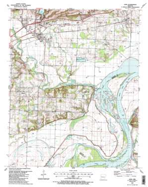
Alma Topo Map Arkansas
To zoom in, hover over the map of Alma
USGS Topo Quad 35094d2 - 1:24,000 scale
| Topo Map Name: | Alma |
| USGS Topo Quad ID: | 35094d2 |
| Print Size: | ca. 21 1/4" wide x 27" high |
| Southeast Coordinates: | 35.375° N latitude / 94.125° W longitude |
| Map Center Coordinates: | 35.4375° N latitude / 94.1875° W longitude |
| U.S. State: | AR |
| Filename: | o35094d2.jpg |
| Download Map JPG Image: | Alma topo map 1:24,000 scale |
| Map Type: | Topographic |
| Topo Series: | 7.5´ |
| Map Scale: | 1:24,000 |
| Source of Map Images: | United States Geological Survey (USGS) |
| Alternate Map Versions: |
Alma AR 1948, updated 1971 Download PDF Buy paper map Alma AR 1948, updated 1978 Download PDF Buy paper map Alma AR 1951 Download PDF Buy paper map Alma AR 1976, updated 1978 Download PDF Buy paper map Alma AR 1987, updated 1988 Download PDF Buy paper map Alma AR 2011 Download PDF Buy paper map Alma AR 2014 Download PDF Buy paper map |
1:24,000 Topo Quads surrounding Alma
> Back to 35094a1 at 1:100,000 scale
> Back to 35094a1 at 1:250,000 scale
> Back to U.S. Topo Maps home
Alma topo map: Gazetteer
Alma: Channels
Arbuckle Island Cutoff elevation 112m 367′Alma: Crossings
Interchange 13 elevation 128m 419′Alma: Dams
Hall Lake Dam elevation 119m 390′Lake Alma Dam elevation 150m 492′
Alma: Guts
Courthouse Slough elevation 113m 370′Alma: Islands
Arbuckle Island elevation 117m 383′Alma: Oilfields
Alma Gas Field elevation 121m 396′Kibler Gas Field elevation 117m 383′
Alma: Parks
Clear Creek Public Use Area elevation 126m 413′Alma: Populated Places
Alma elevation 129m 423′Cross Lanes elevation 119m 390′
Dyer elevation 127m 416′
Island elevation 128m 419′
Kibler elevation 133m 436′
New Town elevation 139m 456′
Yoestown elevation 129m 423′
Alma: Post Offices
Alma Post Office elevation 129m 423′Alma: Reservoirs
Hall Lake elevation 119m 390′Lake Alma elevation 150m 492′
Alma: Streams
Big Creek elevation 113m 370′Curry Branch elevation 119m 390′
Frog Bayou elevation 114m 374′
Herd Branch elevation 115m 377′
Little Frog Bayou elevation 113m 370′
Mays Branch elevation 113m 370′
Onion Creek elevation 114m 374′
Prairie Branch elevation 116m 380′
Tadpole Branch elevation 116m 380′
Alma digital topo map on disk
Buy this Alma topo map showing relief, roads, GPS coordinates and other geographical features, as a high-resolution digital map file on DVD:


