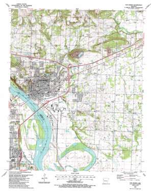
Van Buren Topo Map Arkansas
To zoom in, hover over the map of Van Buren
USGS Topo Quad 35094d3 - 1:24,000 scale
| Topo Map Name: | Van Buren |
| USGS Topo Quad ID: | 35094d3 |
| Print Size: | ca. 21 1/4" wide x 27" high |
| Southeast Coordinates: | 35.375° N latitude / 94.25° W longitude |
| Map Center Coordinates: | 35.4375° N latitude / 94.3125° W longitude |
| U.S. State: | AR |
| Filename: | o35094d3.jpg |
| Download Map JPG Image: | Van Buren topo map 1:24,000 scale |
| Map Type: | Topographic |
| Topo Series: | 7.5´ |
| Map Scale: | 1:24,000 |
| Source of Map Images: | United States Geological Survey (USGS) |
| Alternate Map Versions: |
Van Buren AR 1947, updated 1969 Download PDF Buy paper map Van Buren AR 1947, updated 1971 Download PDF Buy paper map Van Buren AR 1951 Download PDF Buy paper map Van Buren AR 1976, updated 1978 Download PDF Buy paper map Van Buren AR 1976, updated 1987 Download PDF Buy paper map Van Buren AR 1987, updated 1988 Download PDF Buy paper map Van Buren AR 1987, updated 1988 Download PDF Buy paper map Van Buren AR 1997, updated 1999 Download PDF Buy paper map Van Buren AR 2011 Download PDF Buy paper map Van Buren AR 2014 Download PDF Buy paper map |
1:24,000 Topo Quads surrounding Van Buren
> Back to 35094a1 at 1:100,000 scale
> Back to 35094a1 at 1:250,000 scale
> Back to U.S. Topo Maps home
Van Buren topo map: Gazetteer
Van Buren: Airports
Crawford Memorial Hospital Heliport elevation 135m 442′Twin City Airport elevation 121m 396′
Van Buren: Bridges
Broadway Bridge elevation 121m 396′Byrns Bridge elevation 137m 449′
Van Buren: Crossings
Interchange 1 elevation 136m 446′Interchange 3 elevation 125m 410′
Interchange 5 elevation 151m 495′
Interchange 5 elevation 131m 429′
Interchange 6 elevation 133m 436′
Interchange 7 elevation 146m 479′
Van Buren: Dams
Crain Lake Dam elevation 130m 426′Lake Lou Emma Dam elevation 150m 492′
Van Buren: Lakes
Hollis Lake elevation 114m 374′Ned Lake elevation 117m 383′
Van Buren: Oilfields
Hollis Lake Gas Field elevation 119m 390′Section 10 Gas Field elevation 121m 396′
Shibley Gas Field elevation 131m 429′
Van Buren: Parks
Fort Smith Park elevation 124m 406′Lake Louemma Park elevation 151m 495′
Meyer Park elevation 123m 403′
Pointers Athletic Field elevation 139m 456′
Springhill Park elevation 147m 482′
Van Buren Historic District elevation 125m 410′
Van Buren Municipal Park elevation 160m 524′
Van Buren: Populated Places
Catcher elevation 138m 452′Concord elevation 148m 485′
Eastgate Place elevation 140m 459′
Furry elevation 168m 551′
Meadows elevation 140m 459′
Oak Grove elevation 159m 521′
Rena elevation 192m 629′
Shibley elevation 137m 449′
Smeltzer elevation 144m 472′
Van Buren elevation 126m 413′
Westville elevation 136m 446′
Wright Town elevation 143m 469′
Van Buren: Post Offices
Van Buren Post Office elevation 125m 410′Van Buren: Reservoirs
Crain Lake elevation 130m 426′Louemma Lake elevation 150m 492′
Van Buren Water Reservoir elevation 196m 643′
Van Buren: Streams
Flat Rock Creek elevation 115m 377′Van Buren digital topo map on disk
Buy this Van Buren topo map showing relief, roads, GPS coordinates and other geographical features, as a high-resolution digital map file on DVD:


