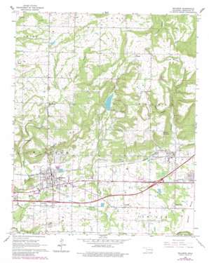
Muldrow Topo Map Oklahoma
To zoom in, hover over the map of Muldrow
USGS Topo Quad 35094d5 - 1:24,000 scale
| Topo Map Name: | Muldrow |
| USGS Topo Quad ID: | 35094d5 |
| Print Size: | ca. 21 1/4" wide x 27" high |
| Southeast Coordinates: | 35.375° N latitude / 94.5° W longitude |
| Map Center Coordinates: | 35.4375° N latitude / 94.5625° W longitude |
| U.S. State: | OK |
| Filename: | o35094d5.jpg |
| Download Map JPG Image: | Muldrow topo map 1:24,000 scale |
| Map Type: | Topographic |
| Topo Series: | 7.5´ |
| Map Scale: | 1:24,000 |
| Source of Map Images: | United States Geological Survey (USGS) |
| Alternate Map Versions: |
Muldrow OK 1966, updated 1967 Download PDF Buy paper map Muldrow OK 1966, updated 1983 Download PDF Buy paper map Muldrow OK 2010 Download PDF Buy paper map Muldrow OK 2012 Download PDF Buy paper map Muldrow OK 2016 Download PDF Buy paper map |
1:24,000 Topo Quads surrounding Muldrow
> Back to 35094a1 at 1:100,000 scale
> Back to 35094a1 at 1:250,000 scale
> Back to U.S. Topo Maps home
Muldrow topo map: Gazetteer
Muldrow: Dams
Muldrow Dam elevation 219m 718′Oknoname 135003 Dam elevation 251m 823′
Muldrow: Flats
Moffett Bottom elevation 126m 413′Muldrow: Populated Places
Liberty elevation 245m 803′Lone Oak elevation 150m 492′
Long elevation 261m 856′
Muldrow elevation 154m 505′
Remy elevation 240m 787′
Roland elevation 147m 482′
Shady Grove elevation 137m 449′
Muldrow: Reservoirs
Muldrow Lake elevation 219m 718′Oknoname 135003 Reservoir elevation 251m 823′
Muldrow: Summits
Flat Rock elevation 161m 528′Mayfield Mountain elevation 251m 823′
O'Neal Hill elevation 270m 885′
Petree Mountain elevation 293m 961′
Turnham Mountain elevation 264m 866′
Muldrow: Valleys
Remy Hollow elevation 173m 567′Muldrow digital topo map on disk
Buy this Muldrow topo map showing relief, roads, GPS coordinates and other geographical features, as a high-resolution digital map file on DVD:


