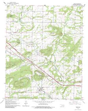
Gans Topo Map Oklahoma
To zoom in, hover over the map of Gans
USGS Topo Quad 35094d6 - 1:24,000 scale
| Topo Map Name: | Gans |
| USGS Topo Quad ID: | 35094d6 |
| Print Size: | ca. 21 1/4" wide x 27" high |
| Southeast Coordinates: | 35.375° N latitude / 94.625° W longitude |
| Map Center Coordinates: | 35.4375° N latitude / 94.6875° W longitude |
| U.S. State: | OK |
| Filename: | o35094d6.jpg |
| Download Map JPG Image: | Gans topo map 1:24,000 scale |
| Map Type: | Topographic |
| Topo Series: | 7.5´ |
| Map Scale: | 1:24,000 |
| Source of Map Images: | United States Geological Survey (USGS) |
| Alternate Map Versions: |
Gans OK 1966, updated 1967 Download PDF Buy paper map Gans OK 1966, updated 1986 Download PDF Buy paper map Gans OK 2010 Download PDF Buy paper map Gans OK 2012 Download PDF Buy paper map Gans OK 2016 Download PDF Buy paper map |
1:24,000 Topo Quads surrounding Gans
> Back to 35094a1 at 1:100,000 scale
> Back to 35094a1 at 1:250,000 scale
> Back to U.S. Topo Maps home
Gans topo map: Gazetteer
Gans: Dams
Oknoname 135001 Dam elevation 141m 462′Oknoname 135002 Dam elevation 182m 597′
Sallisaw Creek Site 38 Dam elevation 172m 564′
Sallisaw Creek Site 39 Dam elevation 156m 511′
Sallisaw Creek Site 40 Dam elevation 164m 538′
Gans: Populated Places
Blackjack elevation 211m 692′Gans elevation 165m 541′
Hanson elevation 177m 580′
Maple elevation 215m 705′
Seven Oaks elevation 167m 547′
Gans: Reservoirs
Oknoname 135001 Reservoir elevation 141m 462′Oknoname 135002 Reservoir elevation 182m 597′
Sallisaw Creek Site 38 Reservoir elevation 172m 564′
Sallisaw Creek Site 39 Reservoir elevation 156m 511′
Sallisaw Creek Site 40 Reservoir elevation 164m 538′
Gans: Ridges
Hickorynut Ridge elevation 228m 748′Miller Ridge elevation 213m 698′
Gans: Streams
Black Creek elevation 165m 541′Cedar Creek elevation 171m 561′
Cedar Creek elevation 165m 541′
Garvin Branch elevation 149m 488′
Little Skin Bayou elevation 132m 433′
Prairie Creek elevation 159m 521′
Ross Branch elevation 159m 521′
Wilson Branch elevation 146m 479′
Wolf Creek elevation 146m 479′
Gans: Summits
Baldridge Mountain elevation 194m 636′Burrow Mountain elevation 221m 725′
Hanson Mountain elevation 255m 836′
Krumpe Mountain elevation 252m 826′
Lone Pine Mountain elevation 226m 741′
Pine Mountain elevation 247m 810′
Gans digital topo map on disk
Buy this Gans topo map showing relief, roads, GPS coordinates and other geographical features, as a high-resolution digital map file on DVD:


