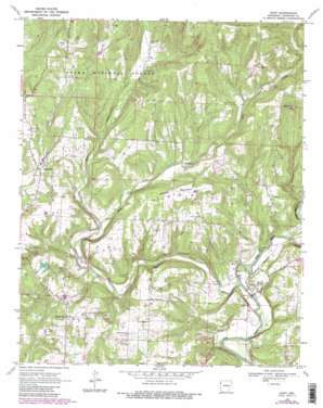
Rudy Topo Map Arkansas
To zoom in, hover over the map of Rudy
USGS Topo Quad 35094e3 - 1:24,000 scale
| Topo Map Name: | Rudy |
| USGS Topo Quad ID: | 35094e3 |
| Print Size: | ca. 21 1/4" wide x 27" high |
| Southeast Coordinates: | 35.5° N latitude / 94.25° W longitude |
| Map Center Coordinates: | 35.5625° N latitude / 94.3125° W longitude |
| U.S. State: | AR |
| Filename: | o35094e3.jpg |
| Download Map JPG Image: | Rudy topo map 1:24,000 scale |
| Map Type: | Topographic |
| Topo Series: | 7.5´ |
| Map Scale: | 1:24,000 |
| Source of Map Images: | United States Geological Survey (USGS) |
| Alternate Map Versions: |
Rudy AR 1969, updated 1971 Download PDF Buy paper map Rudy AR 1969, updated 1975 Download PDF Buy paper map Rudy AR 1969, updated 1983 Download PDF Buy paper map Rudy AR 1969, updated 1983 Download PDF Buy paper map Rudy AR 2011 Download PDF Buy paper map Rudy AR 2014 Download PDF Buy paper map |
| FStopo: | US Forest Service topo Rudy is available: Download FStopo PDF Download FStopo TIF |
1:24,000 Topo Quads surrounding Rudy
> Back to 35094e1 at 1:100,000 scale
> Back to 35094a1 at 1:250,000 scale
> Back to U.S. Topo Maps home
Rudy topo map: Gazetteer
Rudy: Dams
Beverly Hills Lake Dam elevation 245m 803′Rudy: Oilfields
Rudy Gas Field elevation 247m 810′Rudy: Populated Places
Ball elevation 147m 482′Cedarville elevation 240m 787′
Figure Five elevation 278m 912′
Hobbtown elevation 250m 820′
Rudy elevation 149m 488′
Rudy: Post Offices
Cedarville Post Office elevation 236m 774′Rudy: Reservoirs
Beverly Hills Lake elevation 245m 803′Rudy: Springs
Oliver Springs elevation 241m 790′Rudy: Streams
Cedar Creek elevation 146m 479′East Cedar Creek elevation 200m 656′
West Cedar Creek elevation 200m 656′
Rudy: Summits
High Rock elevation 398m 1305′Winset Mountain elevation 324m 1062′
Rudy digital topo map on disk
Buy this Rudy topo map showing relief, roads, GPS coordinates and other geographical features, as a high-resolution digital map file on DVD:


