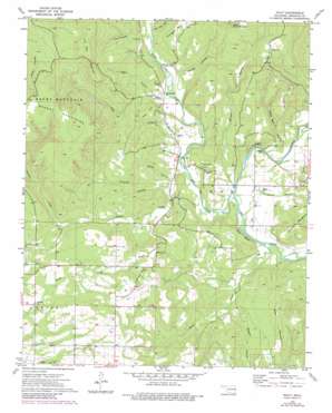
Nicut Topo Map Oklahoma
To zoom in, hover over the map of Nicut
USGS Topo Quad 35094e5 - 1:24,000 scale
| Topo Map Name: | Nicut |
| USGS Topo Quad ID: | 35094e5 |
| Print Size: | ca. 21 1/4" wide x 27" high |
| Southeast Coordinates: | 35.5° N latitude / 94.5° W longitude |
| Map Center Coordinates: | 35.5625° N latitude / 94.5625° W longitude |
| U.S. State: | OK |
| Filename: | o35094e5.jpg |
| Download Map JPG Image: | Nicut topo map 1:24,000 scale |
| Map Type: | Topographic |
| Topo Series: | 7.5´ |
| Map Scale: | 1:24,000 |
| Source of Map Images: | United States Geological Survey (USGS) |
| Alternate Map Versions: |
Nicut OK 1973, updated 1974 Download PDF Buy paper map Nicut OK 1973, updated 1983 Download PDF Buy paper map Nicut OK 2010 Download PDF Buy paper map Nicut OK 2012 Download PDF Buy paper map Nicut OK 2016 Download PDF Buy paper map |
1:24,000 Topo Quads surrounding Nicut
> Back to 35094e1 at 1:100,000 scale
> Back to 35094a1 at 1:250,000 scale
> Back to U.S. Topo Maps home
Nicut topo map: Gazetteer
Nicut: Cliffs
Star Bluff elevation 183m 600′Nicut: Populated Places
Belfonte elevation 244m 800′Copic Slab elevation 194m 636′
Nicut elevation 177m 580′
Reeder Ford elevation 152m 498′
Nicut: Streams
Briar Creek elevation 146m 479′Little Lee Creek elevation 146m 479′
Mission Branch elevation 146m 479′
Polecat Creek elevation 154m 505′
Salt Creek elevation 157m 515′
Short Branch elevation 146m 479′
Nicut: Summits
Blackbird Mountain elevation 234m 767′Eagle Mountain elevation 282m 925′
Flanagan Mountain elevation 275m 902′
Judy Hill elevation 244m 800′
Low Gap Mountain elevation 406m 1332′
Pine Mountain elevation 257m 843′
Nicut: Valleys
Board Hollow elevation 161m 528′Dead Man Hollow elevation 157m 515′
Eagle Hollow elevation 183m 600′
Fork Handle Hollow elevation 181m 593′
Hunt Mill Hollow elevation 178m 583′
Procter Hollow elevation 164m 538′
Rabbit Hollow elevation 170m 557′
Smith Hollow elevation 160m 524′
Nicut digital topo map on disk
Buy this Nicut topo map showing relief, roads, GPS coordinates and other geographical features, as a high-resolution digital map file on DVD:


