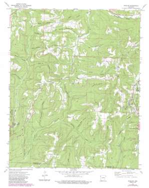
Winslow Topo Map Arkansas
To zoom in, hover over the map of Winslow
USGS Topo Quad 35094g2 - 1:24,000 scale
| Topo Map Name: | Winslow |
| USGS Topo Quad ID: | 35094g2 |
| Print Size: | ca. 21 1/4" wide x 27" high |
| Southeast Coordinates: | 35.75° N latitude / 94.125° W longitude |
| Map Center Coordinates: | 35.8125° N latitude / 94.1875° W longitude |
| U.S. State: | AR |
| Filename: | o35094g2.jpg |
| Download Map JPG Image: | Winslow topo map 1:24,000 scale |
| Map Type: | Topographic |
| Topo Series: | 7.5´ |
| Map Scale: | 1:24,000 |
| Source of Map Images: | United States Geological Survey (USGS) |
| Alternate Map Versions: |
Winslow AR 1973, updated 1976 Download PDF Buy paper map Winslow AR 1973, updated 1983 Download PDF Buy paper map Winslow AR 1973, updated 1987 Download PDF Buy paper map Winslow AR 2011 Download PDF Buy paper map Winslow AR 2014 Download PDF Buy paper map |
| FStopo: | US Forest Service topo Winslow is available: Download FStopo PDF Download FStopo TIF |
1:24,000 Topo Quads surrounding Winslow
> Back to 35094e1 at 1:100,000 scale
> Back to 35094a1 at 1:250,000 scale
> Back to U.S. Topo Maps home
Winslow topo map: Gazetteer
Winslow: Populated Places
Banyard elevation 604m 1981′Blackburn elevation 576m 1889′
Winslow elevation 527m 1729′
Winslow: Post Offices
Blackburn Post Office (historical) elevation 573m 1879′Winslow: Streams
Hess Creek elevation 368m 1207′Riley Creek elevation 454m 1489′
Sinclair Creek elevation 495m 1624′
Winslow: Valleys
Boyd Hollow elevation 433m 1420′Coal Bank Hollow elevation 351m 1151′
Courtney Hollow elevation 404m 1325′
Dripoff Hollow elevation 352m 1154′
Falls Hollow elevation 494m 1620′
Filmore Parrish Hollow elevation 406m 1332′
Flander Hollow elevation 510m 1673′
Gafield Hollow elevation 439m 1440′
Gum Spring Hollow elevation 455m 1492′
Honey Hollow elevation 407m 1335′
Porter Hollow elevation 462m 1515′
Rich Hollow elevation 362m 1187′
Rose Hollow elevation 390m 1279′
Rotten Bluff Hollow elevation 401m 1315′
Wattle Hollow elevation 365m 1197′
Weaver Hollow elevation 457m 1499′
Winslow digital topo map on disk
Buy this Winslow topo map showing relief, roads, GPS coordinates and other geographical features, as a high-resolution digital map file on DVD:


