Stilwell East Topo Map Oklahoma
To zoom in, hover over the map of Stilwell East
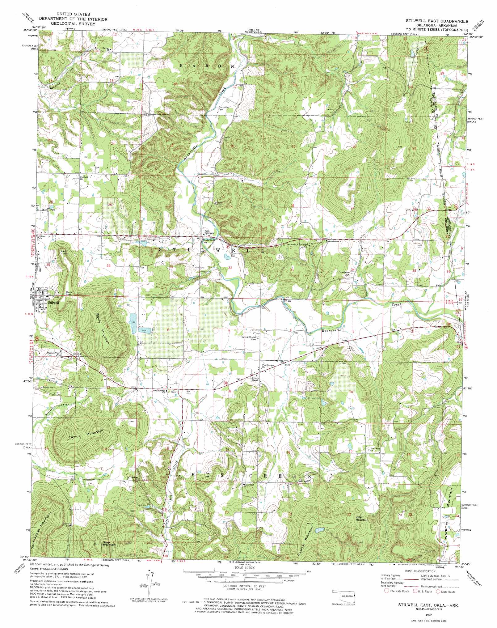
USGS Topo Quad 35094g5 - 1:24,000 scale
| Topo Map Name: | Stilwell East |
| USGS Topo Quad ID: | 35094g5 |
| Print Size: | ca. 21 1/4" wide x 27" high |
| Southeast Coordinates: | 35.75° N latitude / 94.5° W longitude |
| Map Center Coordinates: | 35.8125° N latitude / 94.5625° W longitude |
| U.S. States: | OK, AR |
| Filename: | o35094g5.jpg |
| Download Map JPG Image: | Stilwell East topo map 1:24,000 scale |
| Map Type: | Topographic |
| Topo Series: | 7.5´ |
| Map Scale: | 1:24,000 |
| Source of Map Images: | United States Geological Survey (USGS) |
| Alternate Map Versions: |
Stilwell East OK 1972, updated 1974 Download PDF Buy paper map Stilwell East OK 2011 Download PDF Buy paper map Stilwell East OK 2012 Download PDF Buy paper map Stilwell East OK 2016 Download PDF Buy paper map |
1:24,000 Topo Quads surrounding Stilwell East
Chewey |
Chance |
Watts |
Rhea |
Wheeler |
Proctor |
Christie |
Westville |
Lincoln |
Prairie Grove |
Tailholt |
Stilwell West |
Stilwell East |
Evansville |
Strickler |
Bunch |
Greasy |
Big Round Mountain |
Natural Dam |
Rudy Ne |
Marble City |
Brushy |
Nicut |
Uniontown |
Rudy |
> Back to 35094e1 at 1:100,000 scale
> Back to 35094a1 at 1:250,000 scale
> Back to U.S. Topo Maps home
Stilwell East topo map: Gazetteer
Stilwell East: Airports
Stilwell Memorial Hospital Heliport elevation 350m 1148′Stilwell East: Dams
Orchard Dam elevation 412m 1351′Stillwell Orchard Pond Dam elevation 353m 1158′
Stilwell East: Populated Places
Fairfield elevation 348m 1141′Salem elevation 392m 1286′
Stilwell East: Reservoirs
Orchard Lake elevation 412m 1351′Stillwell Orchard Pond elevation 353m 1158′
Stilwell East: Summits
Davis Mountain elevation 491m 1610′Doublehead Mountain elevation 498m 1633′
Killer Mountain elevation 497m 1630′
Muskrat Mountain elevation 498m 1633′
Soap Mountain elevation 472m 1548′
Taylor Mountain elevation 462m 1515′
Stilwell East digital topo map on disk
Buy this Stilwell East topo map showing relief, roads, GPS coordinates and other geographical features, as a high-resolution digital map file on DVD: