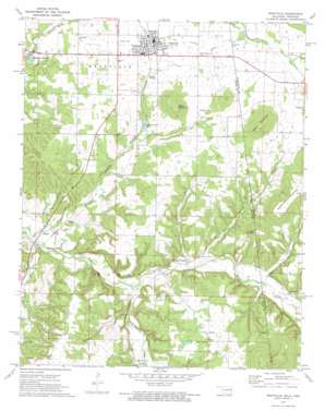
Westville Topo Map Oklahoma
To zoom in, hover over the map of Westville
USGS Topo Quad 35094h5 - 1:24,000 scale
| Topo Map Name: | Westville |
| USGS Topo Quad ID: | 35094h5 |
| Print Size: | ca. 21 1/4" wide x 27" high |
| Southeast Coordinates: | 35.875° N latitude / 94.5° W longitude |
| Map Center Coordinates: | 35.9375° N latitude / 94.5625° W longitude |
| U.S. States: | OK, AR |
| Filename: | o35094h5.jpg |
| Download Map JPG Image: | Westville topo map 1:24,000 scale |
| Map Type: | Topographic |
| Topo Series: | 7.5´ |
| Map Scale: | 1:24,000 |
| Source of Map Images: | United States Geological Survey (USGS) |
| Alternate Map Versions: |
Westville OK 1972, updated 1974 Download PDF Buy paper map Westville OK 2011 Download PDF Buy paper map Westville OK 2012 Download PDF Buy paper map Westville OK 2016 Download PDF Buy paper map |
1:24,000 Topo Quads surrounding Westville
> Back to 35094e1 at 1:100,000 scale
> Back to 35094a1 at 1:250,000 scale
> Back to U.S. Topo Maps home
Westville topo map: Gazetteer
Westville: Populated Places
Baron elevation 267m 875′Peavine elevation 334m 1095′
Piney elevation 354m 1161′
Sexton (historical) elevation 309m 1013′
Westville elevation 343m 1125′
Westville: Post Offices
Sexton Post Office (historical) elevation 310m 1017′Westville: Reservoirs
Westville Reservoir elevation 294m 964′Westville: Streams
Evansville Creek elevation 270m 885′Funkhouser Branch elevation 342m 1122′
Little Branch elevation 296m 971′
Peavine Creek elevation 261m 856′
Shell Branch elevation 261m 856′
West Branch elevation 278m 912′
West Branch Baron Fork elevation 281m 921′
Westville: Summits
Alberty Mountain elevation 429m 1407′Snake Mountain elevation 435m 1427′
West Mountain elevation 455m 1492′
Westville digital topo map on disk
Buy this Westville topo map showing relief, roads, GPS coordinates and other geographical features, as a high-resolution digital map file on DVD:


