Quinton South Topo Map Oklahoma
To zoom in, hover over the map of Quinton South
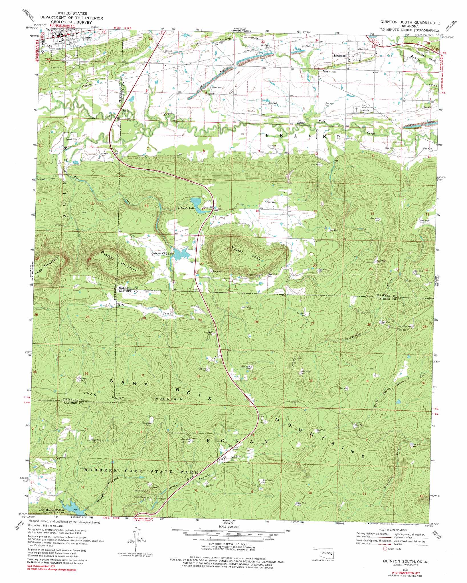
USGS Topo Quad 35095a3 - 1:24,000 scale
| Topo Map Name: | Quinton South |
| USGS Topo Quad ID: | 35095a3 |
| Print Size: | ca. 21 1/4" wide x 27" high |
| Southeast Coordinates: | 35° N latitude / 95.25° W longitude |
| Map Center Coordinates: | 35.0625° N latitude / 95.3125° W longitude |
| U.S. State: | OK |
| Filename: | o35095a3.jpg |
| Download Map JPG Image: | Quinton South topo map 1:24,000 scale |
| Map Type: | Topographic |
| Topo Series: | 7.5´ |
| Map Scale: | 1:24,000 |
| Source of Map Images: | United States Geological Survey (USGS) |
| Alternate Map Versions: |
Quinton South OK 1969, updated 1971 Download PDF Buy paper map Quinton South OK 1969, updated 1980 Download PDF Buy paper map Quinton South OK 1969, updated 1980 Download PDF Buy paper map Quinton South OK 2010 Download PDF Buy paper map Quinton South OK 2012 Download PDF Buy paper map Quinton South OK 2016 Download PDF Buy paper map |
1:24,000 Topo Quads surrounding Quinton South
Eufaula |
Texanna |
Porum |
Stigler West |
Stigler East |
Longtown |
Enterprise |
Quinton North |
Sans Bois |
Lafayette |
Blocker |
Featherston |
Quinton South |
Kinta |
Lequire |
Adamson |
Gowen |
Wilburton |
Panola |
Red Oak |
Hartshorne |
Higgins |
Damon |
Baker Mountain |
Talihina |
> Back to 35095a1 at 1:100,000 scale
> Back to 35094a1 at 1:250,000 scale
> Back to U.S. Topo Maps home
Quinton South topo map: Gazetteer
Quinton South: Dams
Coblentz Lake Dam elevation 271m 889′Quinton Lake Dam elevation 271m 889′
Quinton South: Flats
Black Gum Flats elevation 302m 990′Quinton South: Parks
Robbers Cave State Park elevation 288m 944′Quinton South: Populated Places
Lewisville elevation 183m 600′Quinton elevation 186m 610′
Quinton South: Reservoirs
Coblentz Lake elevation 271m 889′Quinton City Lake elevation 257m 843′
Quinton Lake elevation 271m 889′
Quinton South: Streams
Mill Creek elevation 169m 554′Quinton South: Summits
Iron Post Mountain elevation 447m 1466′Panther Mountain elevation 428m 1404′
Shoe Mountain elevation 448m 1469′
Tucker Knob elevation 453m 1486′
Quinton South: Valleys
Rough Canyon elevation 243m 797′Quinton South digital topo map on disk
Buy this Quinton South topo map showing relief, roads, GPS coordinates and other geographical features, as a high-resolution digital map file on DVD: