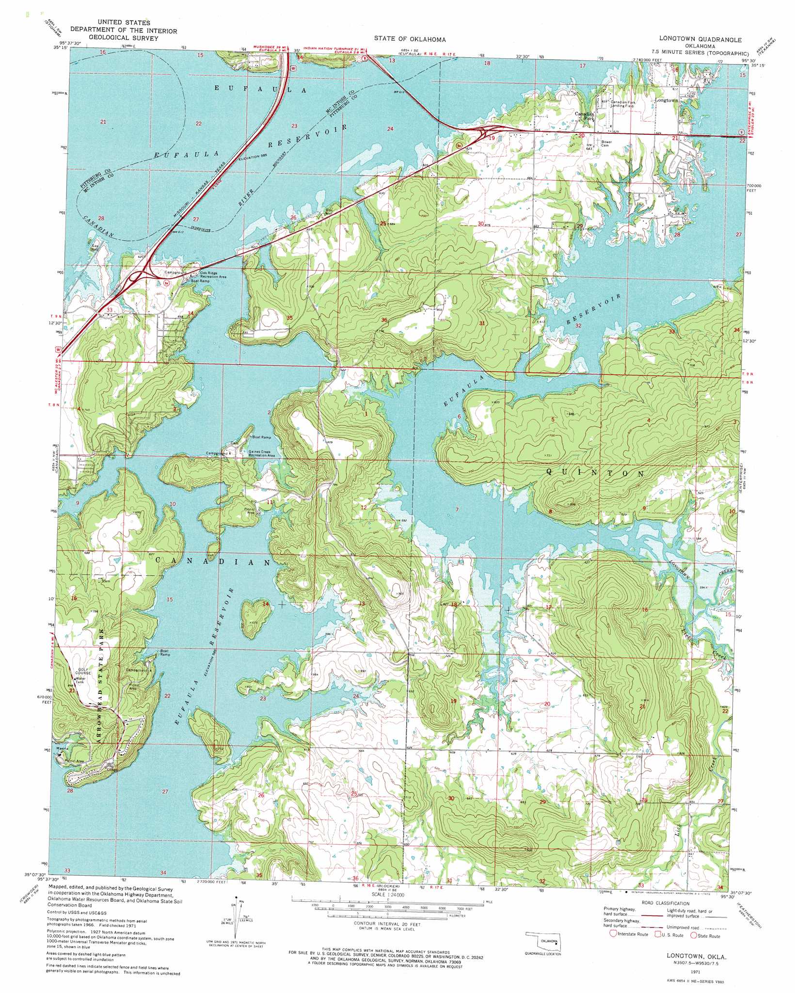
Longtown Topo Map Oklahoma
To zoom in, hover over the map of Longtown
USGS Topo Quad 35095b5 - 1:24,000 scale
| Topo Map Name: | Longtown |
| USGS Topo Quad ID: | 35095b5 |
| Print Size: | ca. 21 1/4" wide x 27" high |
| Southeast Coordinates: | 35.125° N latitude / 95.5° W longitude |
| Map Center Coordinates: | 35.1875° N latitude / 95.5625° W longitude |
| U.S. State: | OK |
| Filename: | o35095b5.jpg |
| Download Map JPG Image: | Longtown topo map 1:24,000 scale |
| Map Type: | Topographic |
| Topo Series: | 7.5´ |
| Map Scale: | 1:24,000 |
| Source of Map Images: | United States Geological Survey (USGS) |
| Alternate Map Versions: |
Longtown OK 1971, updated 1972 Download PDF Buy paper map Longtown OK 2010 Download PDF Buy paper map Longtown OK 2012 Download PDF Buy paper map Longtown OK 2016 Download PDF Buy paper map |
1:24,000 Topo Quads surrounding Longtown
Hoffman |
Pierce |
Checotah |
Warner Nw |
Warner |
Raiford |
Stidham |
Eufaula |
Texanna |
Porum |
Indianola |
Canadian |
Longtown |
Enterprise |
Quinton North |
Lake Mcalester |
Crowder |
Blocker |
Featherston |
Quinton South |
Mcalester |
Krebs |
Adamson |
Gowen |
Wilburton |
> Back to 35095a1 at 1:100,000 scale
> Back to 35094a1 at 1:250,000 scale
> Back to U.S. Topo Maps home
Longtown topo map: Gazetteer
Longtown: Airports
Arrowhead Airport elevation 256m 839′Longtown: Parks
Gaines Creek Recreation Area elevation 189m 620′Oak Ridge Recreation Area elevation 189m 620′
Longtown: Populated Places
Canadian Fork elevation 189m 620′Longtown elevation 187m 613′
Longtown: Streams
Lick Creek elevation 178m 583′Longtown digital topo map on disk
Buy this Longtown topo map showing relief, roads, GPS coordinates and other geographical features, as a high-resolution digital map file on DVD: