Texanna Topo Map Oklahoma
To zoom in, hover over the map of Texanna
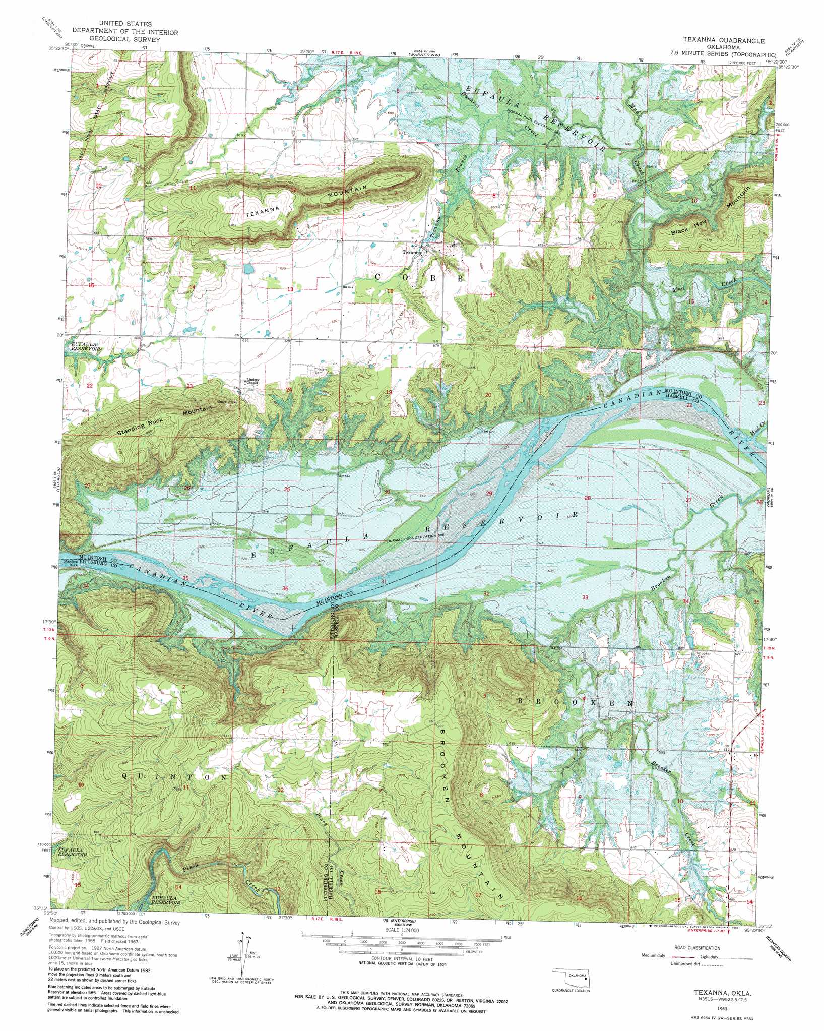
USGS Topo Quad 35095c4 - 1:24,000 scale
| Topo Map Name: | Texanna |
| USGS Topo Quad ID: | 35095c4 |
| Print Size: | ca. 21 1/4" wide x 27" high |
| Southeast Coordinates: | 35.25° N latitude / 95.375° W longitude |
| Map Center Coordinates: | 35.3125° N latitude / 95.4375° W longitude |
| U.S. State: | OK |
| Filename: | o35095c4.jpg |
| Download Map JPG Image: | Texanna topo map 1:24,000 scale |
| Map Type: | Topographic |
| Topo Series: | 7.5´ |
| Map Scale: | 1:24,000 |
| Source of Map Images: | United States Geological Survey (USGS) |
| Alternate Map Versions: |
Texanna OK 1963, updated 1964 Download PDF Buy paper map Texanna OK 1963, updated 1970 Download PDF Buy paper map Texanna OK 1963, updated 1983 Download PDF Buy paper map Texanna OK 2010 Download PDF Buy paper map Texanna OK 2012 Download PDF Buy paper map Texanna OK 2016 Download PDF Buy paper map |
1:24,000 Topo Quads surrounding Texanna
Council Hill |
Wainwright |
Oktaha |
Keefton |
Webbers Falls |
Pierce |
Checotah |
Warner Nw |
Warner |
Holt Mountain |
Stidham |
Eufaula |
Texanna |
Porum |
Stigler West |
Canadian |
Longtown |
Enterprise |
Quinton North |
Sans Bois |
Crowder |
Blocker |
Featherston |
Quinton South |
Kinta |
> Back to 35095a1 at 1:100,000 scale
> Back to 35094a1 at 1:250,000 scale
> Back to U.S. Topo Maps home
Texanna topo map: Gazetteer
Texanna: Dams
Oknoname 131007 Dam elevation 178m 583′Texanna: Populated Places
Texanna elevation 184m 603′Texanna: Reservoirs
Oknoname 131007 Reservoir elevation 178m 583′Texanna: Streams
Duchess Creek elevation 178m 583′Mud Creek elevation 178m 583′
Piney Creek elevation 201m 659′
Texanna Branch elevation 178m 583′
Texanna: Summits
Standing Rock Mountain elevation 275m 902′Texanna Mountain elevation 278m 912′
Texanna digital topo map on disk
Buy this Texanna topo map showing relief, roads, GPS coordinates and other geographical features, as a high-resolution digital map file on DVD: