Keefton Topo Map Oklahoma
To zoom in, hover over the map of Keefton
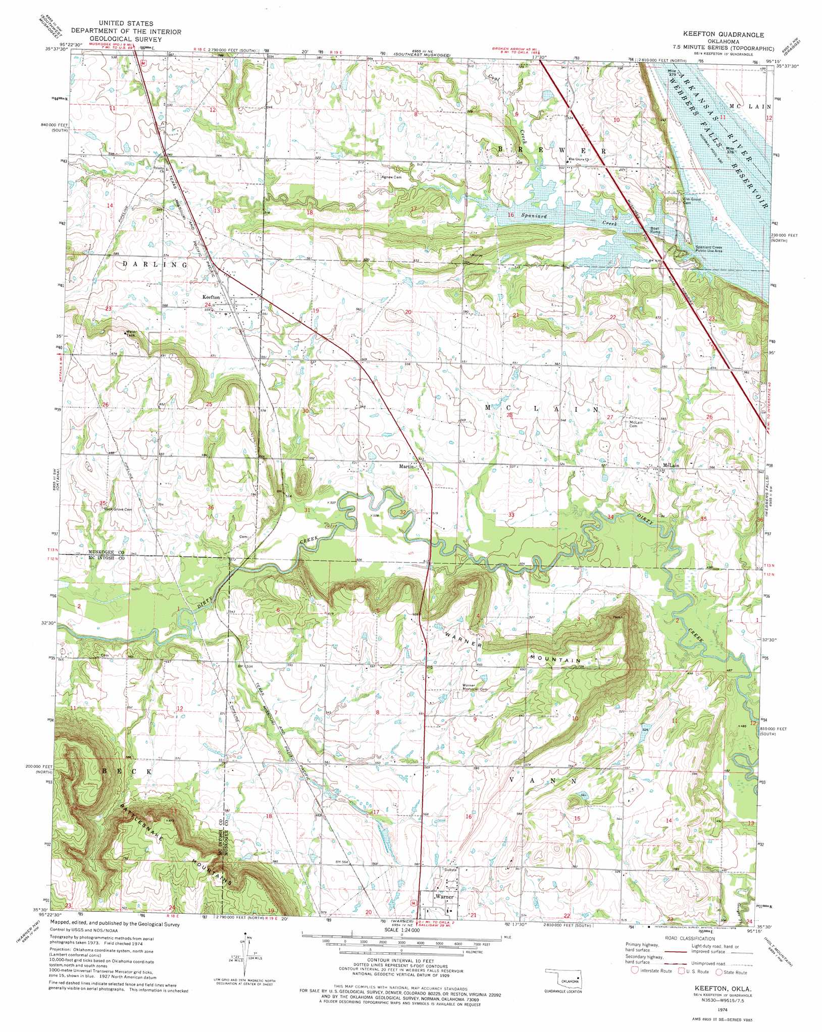
USGS Topo Quad 35095e3 - 1:24,000 scale
| Topo Map Name: | Keefton |
| USGS Topo Quad ID: | 35095e3 |
| Print Size: | ca. 21 1/4" wide x 27" high |
| Southeast Coordinates: | 35.5° N latitude / 95.25° W longitude |
| Map Center Coordinates: | 35.5625° N latitude / 95.3125° W longitude |
| U.S. State: | OK |
| Filename: | o35095e3.jpg |
| Download Map JPG Image: | Keefton topo map 1:24,000 scale |
| Map Type: | Topographic |
| Topo Series: | 7.5´ |
| Map Scale: | 1:24,000 |
| Source of Map Images: | United States Geological Survey (USGS) |
| Alternate Map Versions: |
Keefeton SE OK 1972, updated 1974 Download PDF Buy paper map Keefton OK 1974, updated 1978 Download PDF Buy paper map Keefton OK 2010 Download PDF Buy paper map Keefton OK 2012 Download PDF Buy paper map Keefton OK 2016 Download PDF Buy paper map |
1:24,000 Topo Quads surrounding Keefton
Taft |
Northwest Muskogee |
Northeast Muskogee |
Fort Gibson Dam |
Zeb |
Beland |
Southwest Muskogee |
Southeast Muskogee |
Braggs |
Qualls |
Wainwright |
Oktaha |
Keefton |
Webbers Falls |
Gore |
Checotah |
Warner Nw |
Warner |
Holt Mountain |
Stigler Ne |
Eufaula |
Texanna |
Porum |
Stigler West |
Stigler East |
> Back to 35095e1 at 1:100,000 scale
> Back to 35094a1 at 1:250,000 scale
> Back to U.S. Topo Maps home
Keefton topo map: Gazetteer
Keefton: Dams
Oknoname 101016 Dam elevation 161m 528′Keefton: Parks
Spaniard Creek Public Use Area elevation 153m 501′Keefton: Populated Places
Keefton elevation 170m 557′Martin elevation 162m 531′
McLain elevation 163m 534′
Keefton: Reservoirs
Oknoname 101016 Reservoir elevation 161m 528′Keefton: Streams
Coal Creek elevation 151m 495′Keefton: Summits
Warner Mountain elevation 240m 787′Keefton digital topo map on disk
Buy this Keefton topo map showing relief, roads, GPS coordinates and other geographical features, as a high-resolution digital map file on DVD: