Okmulgee South Topo Map Oklahoma
To zoom in, hover over the map of Okmulgee South
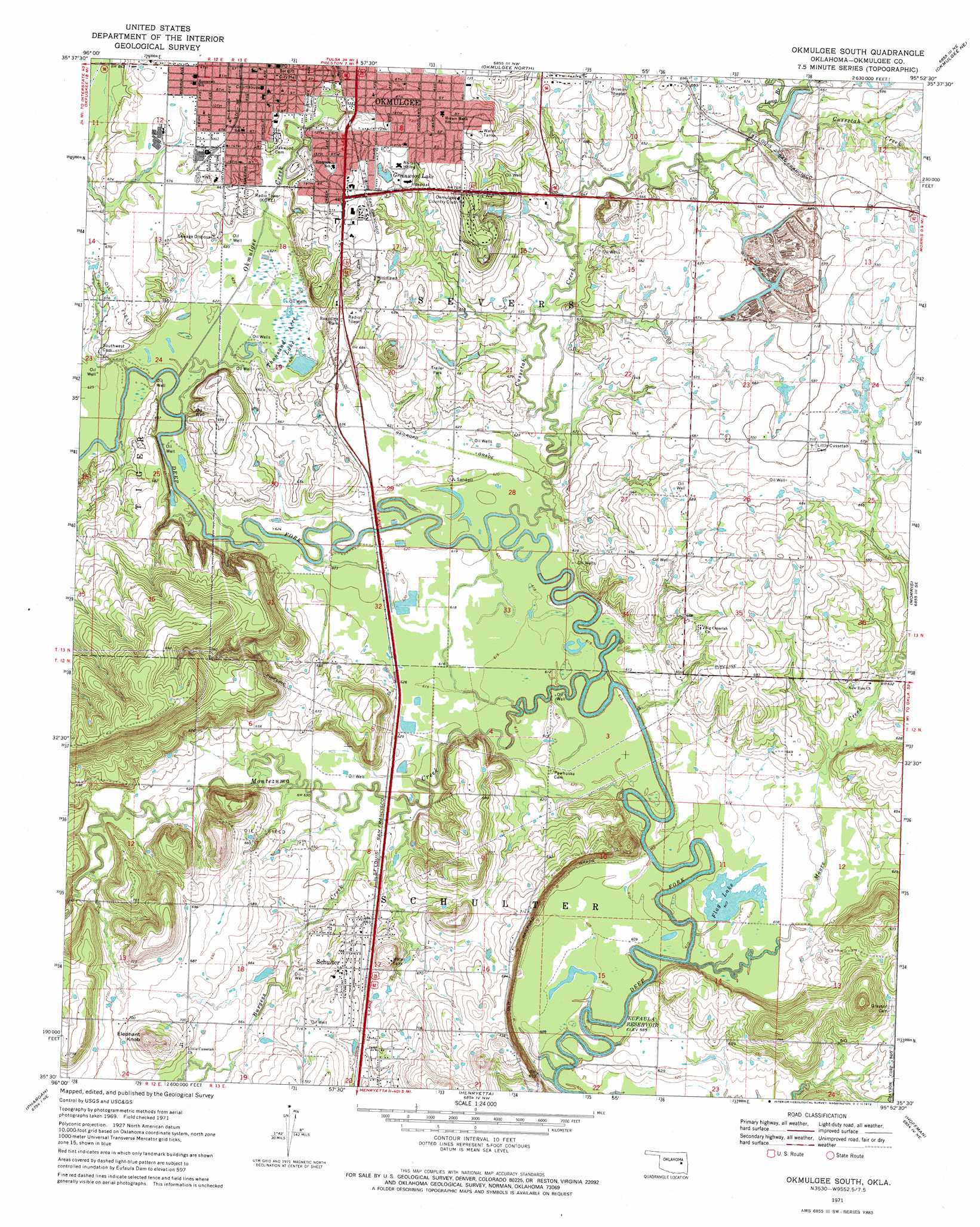
USGS Topo Quad 35095e8 - 1:24,000 scale
| Topo Map Name: | Okmulgee South |
| USGS Topo Quad ID: | 35095e8 |
| Print Size: | ca. 21 1/4" wide x 27" high |
| Southeast Coordinates: | 35.5° N latitude / 95.875° W longitude |
| Map Center Coordinates: | 35.5625° N latitude / 95.9375° W longitude |
| U.S. State: | OK |
| Filename: | o35095e8.jpg |
| Download Map JPG Image: | Okmulgee South topo map 1:24,000 scale |
| Map Type: | Topographic |
| Topo Series: | 7.5´ |
| Map Scale: | 1:24,000 |
| Source of Map Images: | United States Geological Survey (USGS) |
| Alternate Map Versions: |
Okmulgee South OK 1971, updated 1972 Download PDF Buy paper map Okmulgee South OK 2010 Download PDF Buy paper map Okmulgee South OK 2012 Download PDF Buy paper map Okmulgee South OK 2016 Download PDF Buy paper map |
1:24,000 Topo Quads surrounding Okmulgee South
Kiefer Sw |
Lake Boren |
Spanish Peak |
Concharty Mountain |
Haskell |
Nuyaka |
Beggs |
Okmulgee North |
Okmulgee Ne |
Boynton |
Okfuskee |
Okmulgee Lake |
Okmulgee South |
Morris |
Council Hill |
Clearview |
Pharoah |
Henryetta |
Hoffman |
Pierce |
Weleetka |
Dustin |
Henryetta Sw |
Raiford |
Stidham |
> Back to 35095e1 at 1:100,000 scale
> Back to 35094a1 at 1:250,000 scale
> Back to U.S. Topo Maps home
Okmulgee South topo map: Gazetteer
Okmulgee South: Populated Places
Brundidge elevation 200m 656′Okmulgee elevation 207m 679′
Schulter elevation 213m 698′
Okmulgee South: Reservoirs
Flag Lake elevation 185m 606′Greenwood Lake elevation 213m 698′
Thousand Acre Lake elevation 189m 620′
Okmulgee South: Streams
Burgess Creek elevation 186m 610′Cussetah Creek elevation 186m 610′
Long Branch elevation 195m 639′
Montezuma Creek elevation 182m 597′
Moore Creek elevation 180m 590′
Okmulgee Creek elevation 186m 610′
Okmulgee South: Summits
Elephant Knob elevation 259m 849′Okmulgee South digital topo map on disk
Buy this Okmulgee South topo map showing relief, roads, GPS coordinates and other geographical features, as a high-resolution digital map file on DVD: