Boynton Topo Map Oklahoma
To zoom in, hover over the map of Boynton
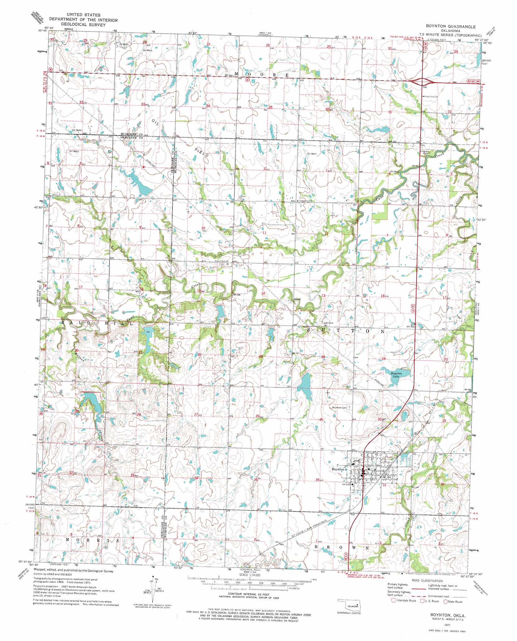
USGS Topo Quad 35095f6 - 1:24,000 scale
| Topo Map Name: | Boynton |
| USGS Topo Quad ID: | 35095f6 |
| Print Size: | ca. 21 1/4" wide x 27" high |
| Southeast Coordinates: | 35.625° N latitude / 95.625° W longitude |
| Map Center Coordinates: | 35.6875° N latitude / 95.6875° W longitude |
| U.S. State: | OK |
| Filename: | o35095f6.jpg |
| Download Map JPG Image: | Boynton topo map 1:24,000 scale |
| Map Type: | Topographic |
| Topo Series: | 7.5´ |
| Map Scale: | 1:24,000 |
| Source of Map Images: | United States Geological Survey (USGS) |
| Alternate Map Versions: |
Boynton OK 1971, updated 1972 Download PDF Buy paper map Boynton OK 1971, updated 1977 Download PDF Buy paper map Boynton OK 2010 Download PDF Buy paper map Boynton OK 2012 Download PDF Buy paper map Boynton OK 2016 Download PDF Buy paper map |
1:24,000 Topo Quads surrounding Boynton
Bixby |
Leonard |
Coweta |
Red Bird |
Wagoner West |
Spanish Peak |
Concharty Mountain |
Haskell |
Taft |
Northwest Muskogee |
Okmulgee North |
Okmulgee Ne |
Boynton |
Beland |
Southwest Muskogee |
Okmulgee South |
Morris |
Council Hill |
Wainwright |
Oktaha |
Henryetta |
Hoffman |
Pierce |
Checotah |
Warner Nw |
> Back to 35095e1 at 1:100,000 scale
> Back to 35094a1 at 1:250,000 scale
> Back to U.S. Topo Maps home
Boynton topo map: Gazetteer
Boynton: Dams
Boynton Lake Dam elevation 182m 597′Cane Creek Site 18 Dam elevation 192m 629′
Cane Creek Site 19 Dam elevation 183m 600′
Cane Creek Site 2 Dam elevation 177m 580′
Cane Creek Site 20 Dam elevation 184m 603′
Cane Creek Site 21 Dam elevation 175m 574′
Cane Creek Site 22 Dam elevation 185m 606′
Cane Creek Site 26a Dam elevation 187m 613′
Cane Creek Site 5 Dam elevation 195m 639′
Boynton: Populated Places
Boynton elevation 190m 623′Boynton: Reservoirs
Boynton Lake elevation 186m 610′Boynton Lake elevation 182m 597′
Cane Creek Site 18 Reservoir elevation 192m 629′
Cane Creek Site 19 Reservoir elevation 183m 600′
Cane Creek Site 2 Reservoir elevation 177m 580′
Cane Creek Site 20 Reservoir elevation 184m 603′
Cane Creek Site 21 Reservoir elevation 175m 574′
Cane Creek Site 22 Reservoir elevation 185m 606′
Cane Creek Site 26a Reservoir elevation 187m 613′
Cane Creek Site 5 Reservoir elevation 195m 639′
Boynton: Streams
Cane Creek elevation 164m 538′Walnut Creek elevation 179m 587′
Boynton digital topo map on disk
Buy this Boynton topo map showing relief, roads, GPS coordinates and other geographical features, as a high-resolution digital map file on DVD: