Zeb Topo Map Oklahoma
To zoom in, hover over the map of Zeb
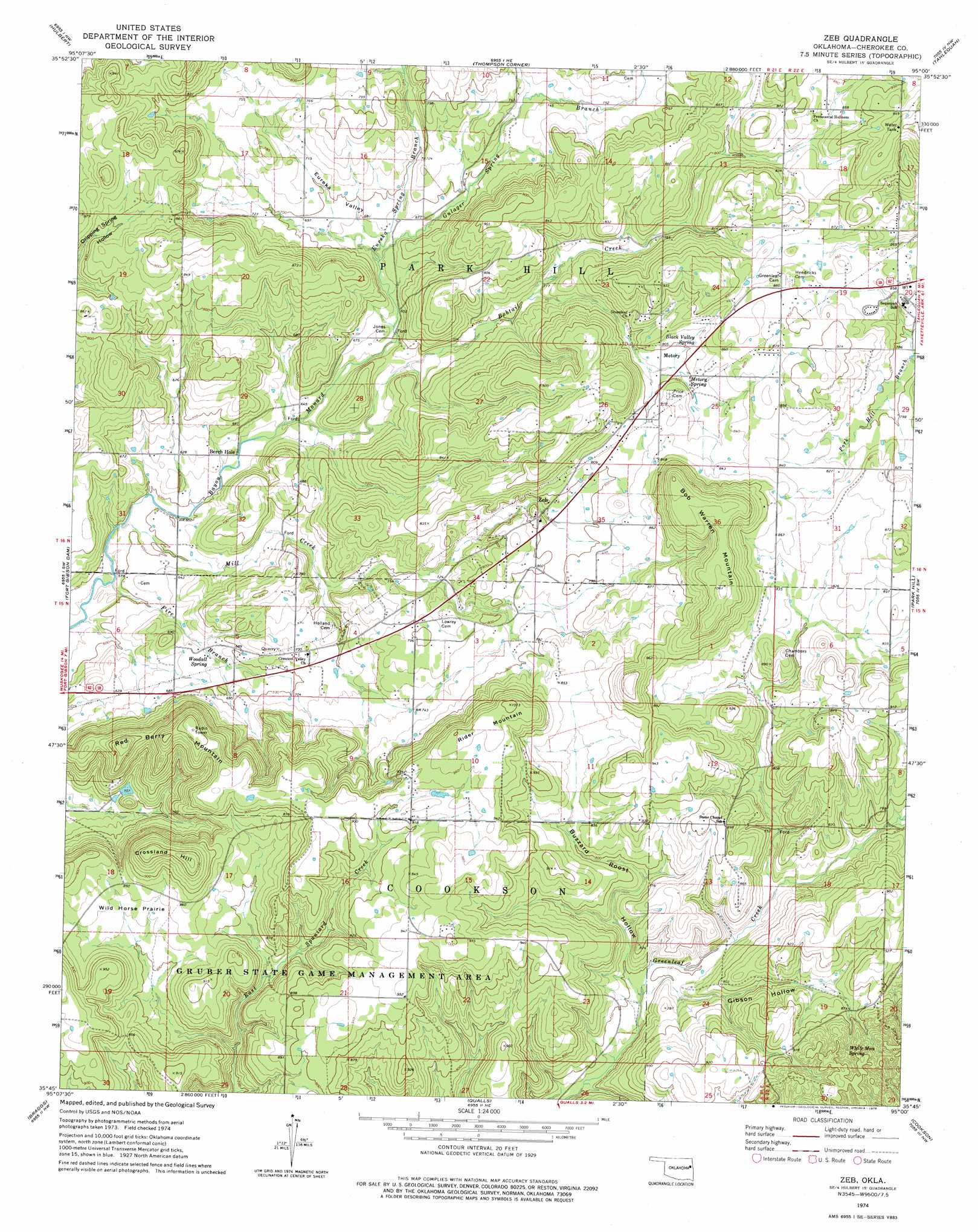
USGS Topo Quad 35095g1 - 1:24,000 scale
| Topo Map Name: | Zeb |
| USGS Topo Quad ID: | 35095g1 |
| Print Size: | ca. 21 1/4" wide x 27" high |
| Southeast Coordinates: | 35.75° N latitude / 95° W longitude |
| Map Center Coordinates: | 35.8125° N latitude / 95.0625° W longitude |
| U.S. State: | OK |
| Filename: | o35095g1.jpg |
| Download Map JPG Image: | Zeb topo map 1:24,000 scale |
| Map Type: | Topographic |
| Topo Series: | 7.5´ |
| Map Scale: | 1:24,000 |
| Source of Map Images: | United States Geological Survey (USGS) |
| Alternate Map Versions: |
Hulbert SE OK 1972, updated 1974 Download PDF Buy paper map Zeb OK 1974, updated 1978 Download PDF Buy paper map Zeb OK 2010 Download PDF Buy paper map Zeb OK 2012 Download PDF Buy paper map Zeb OK 2016 Download PDF Buy paper map |
1:24,000 Topo Quads surrounding Zeb
Rocky Point |
Cedar Crest |
Peggs |
Moodys |
Chewey |
Wagoner East |
Hulbert |
Thompson Corner |
Tahlequah |
Proctor |
Northeast Muskogee |
Fort Gibson Dam |
Zeb |
Park Hill |
Tailholt |
Southeast Muskogee |
Braggs |
Qualls |
Cookson |
Bunch |
Keefton |
Webbers Falls |
Gore |
Blackgum |
Marble City |
> Back to 35095e1 at 1:100,000 scale
> Back to 35094a1 at 1:250,000 scale
> Back to U.S. Topo Maps home
Zeb topo map: Gazetteer
Zeb: Flats
Wild Horse Prairie elevation 250m 820′Zeb: Populated Places
Manard elevation 177m 580′Metory elevation 241m 790′
Woodall elevation 241m 790′
Zeb elevation 239m 784′
Zeb: Springs
Black Valley Spring elevation 247m 810′Metory Spring elevation 243m 797′
White Man Spring elevation 281m 921′
Woodall Spring elevation 199m 652′
Zeb: Streams
Bobtail Creek elevation 189m 620′Eureka Spring Branch elevation 201m 659′
Fire Branch elevation 176m 577′
Gulager Spring Branch elevation 201m 659′
Mill Creek elevation 177m 580′
Zeb: Summits
Bob Warren Mountain elevation 337m 1105′Crossland Hill elevation 314m 1030′
Red Berry Mountain elevation 314m 1030′
Rider Mountain elevation 307m 1007′
Zeb: Valleys
Buzzard Roost Hollow elevation 213m 698′Eureka Valley elevation 206m 675′
Gibson Hollow elevation 218m 715′
Zeb digital topo map on disk
Buy this Zeb topo map showing relief, roads, GPS coordinates and other geographical features, as a high-resolution digital map file on DVD: