Wagoner West Topo Map Oklahoma
To zoom in, hover over the map of Wagoner West
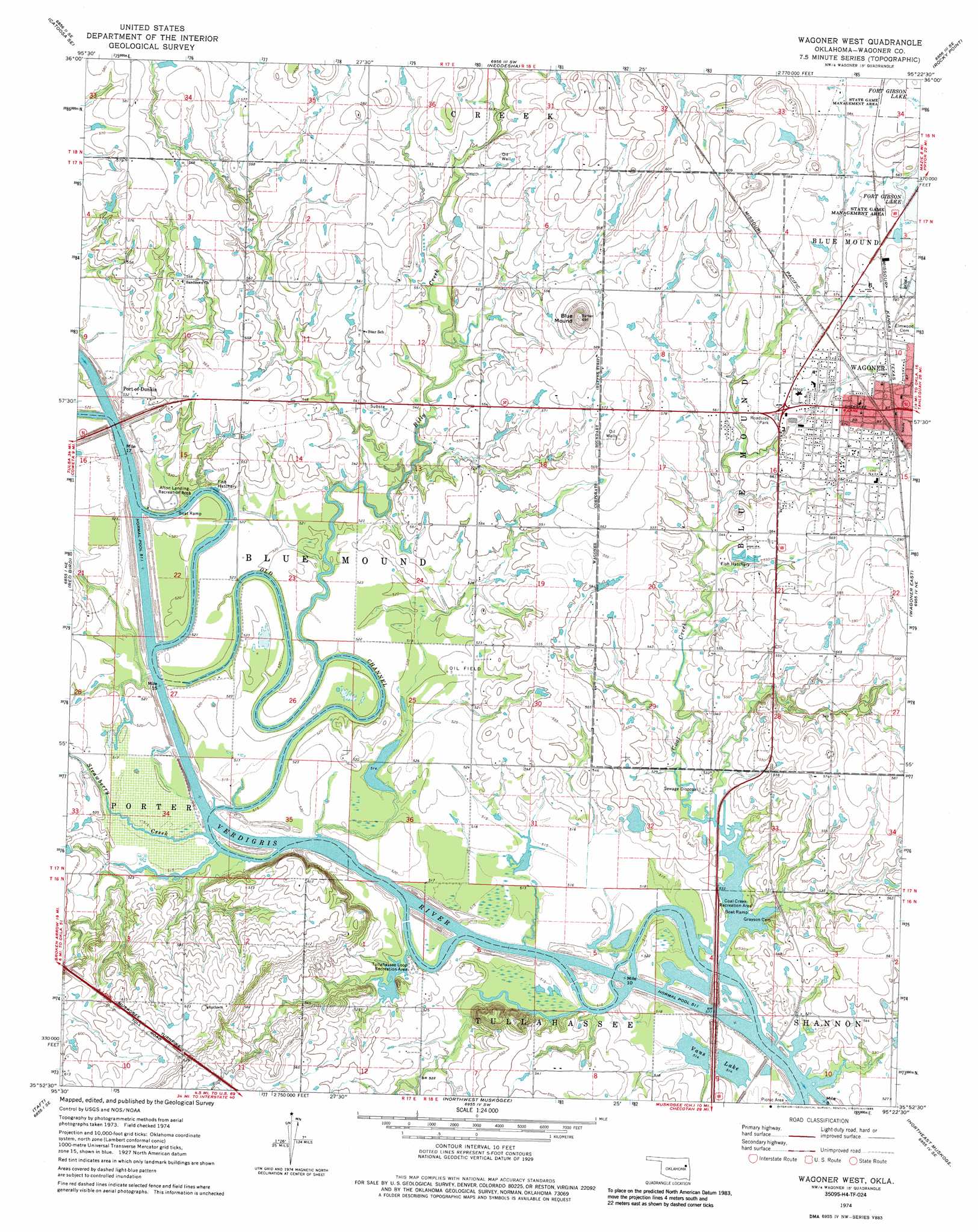
USGS Topo Quad 35095h4 - 1:24,000 scale
| Topo Map Name: | Wagoner West |
| USGS Topo Quad ID: | 35095h4 |
| Print Size: | ca. 21 1/4" wide x 27" high |
| Southeast Coordinates: | 35.875° N latitude / 95.375° W longitude |
| Map Center Coordinates: | 35.9375° N latitude / 95.4375° W longitude |
| U.S. State: | OK |
| Filename: | o35095h4.jpg |
| Download Map JPG Image: | Wagoner West topo map 1:24,000 scale |
| Map Type: | Topographic |
| Topo Series: | 7.5´ |
| Map Scale: | 1:24,000 |
| Source of Map Images: | United States Geological Survey (USGS) |
| Alternate Map Versions: |
Wagoner NW OK 1972, updated 1974 Download PDF Buy paper map Wagoner West OK 1974, updated 1978 Download PDF Buy paper map Wagoner West OK 1974, updated 1986 Download PDF Buy paper map Wagoner West OK 2010 Download PDF Buy paper map Wagoner West OK 2012 Download PDF Buy paper map Wagoner West OK 2016 Download PDF Buy paper map |
1:24,000 Topo Quads surrounding Wagoner West
Catoosa |
Inola |
Choteau Nw |
Chouteau |
Locust Grove |
Oneta |
Catoosa Se |
Neodesha |
Rocky Point |
Cedar Crest |
Coweta |
Red Bird |
Wagoner West |
Wagoner East |
Hulbert |
Haskell |
Taft |
Northwest Muskogee |
Northeast Muskogee |
Fort Gibson Dam |
Boynton |
Beland |
Southwest Muskogee |
Southeast Muskogee |
Braggs |
> Back to 35095e1 at 1:100,000 scale
> Back to 35094a1 at 1:250,000 scale
> Back to U.S. Topo Maps home
Wagoner West topo map: Gazetteer
Wagoner West: Dams
Oknoname 037018 Dam elevation 167m 547′Wagoner West: Lakes
Vans Lake elevation 157m 515′Wagoner West: Parks
Afton Landing Recreation Area elevation 159m 521′Coal Creek Recreation Area elevation 159m 521′
Tullahassee Loop Recreation Area elevation 158m 518′
Wagoner West: Reservoirs
Oknoname 037018 Reservoir elevation 167m 547′Wagoner West: Streams
Billy Creek elevation 156m 511′Coal Creek elevation 156m 511′
Strawberry Creek elevation 156m 511′
Wagoner West: Summits
Blue Mound elevation 208m 682′Wagoner West digital topo map on disk
Buy this Wagoner West topo map showing relief, roads, GPS coordinates and other geographical features, as a high-resolution digital map file on DVD: