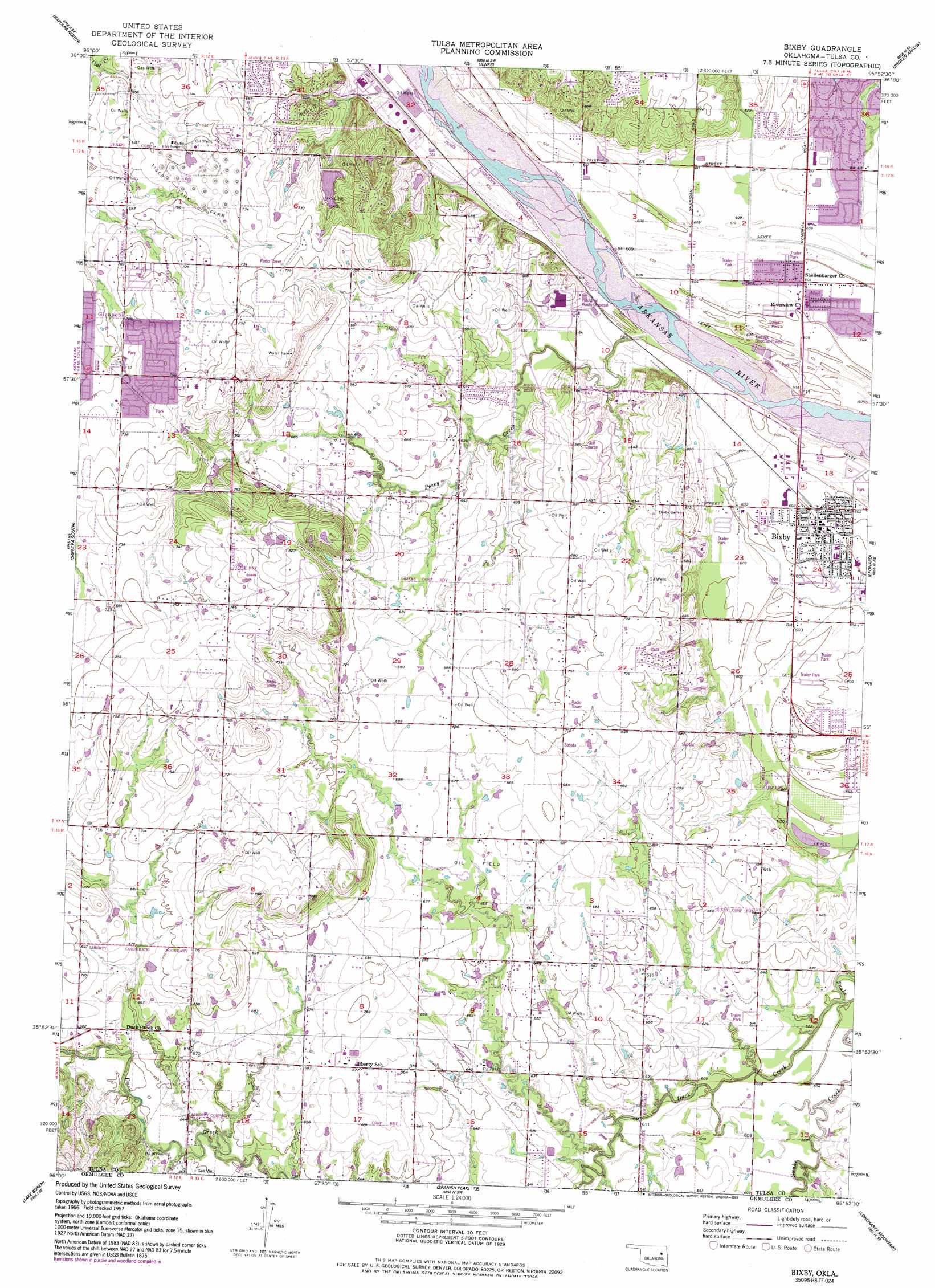
Bixby Topo Map Oklahoma
To zoom in, hover over the map of Bixby
USGS Topo Quad 35095h8 - 1:24,000 scale
| Topo Map Name: | Bixby |
| USGS Topo Quad ID: | 35095h8 |
| Print Size: | ca. 21 1/4" wide x 27" high |
| Southeast Coordinates: | 35.875° N latitude / 95.875° W longitude |
| Map Center Coordinates: | 35.9375° N latitude / 95.9375° W longitude |
| U.S. State: | OK |
| Filename: | o35095h8.jpg |
| Download Map JPG Image: | Bixby topo map 1:24,000 scale |
| Map Type: | Topographic |
| Topo Series: | 7.5´ |
| Map Scale: | 1:24,000 |
| Source of Map Images: | United States Geological Survey (USGS) |
| Alternate Map Versions: |
Bixby OK 1957, updated 1968 Download PDF Buy paper map Bixby OK 1957, updated 1977 Download PDF Buy paper map Bixby OK 1957, updated 1993 Download PDF Buy paper map Bixby OK 2010 Download PDF Buy paper map Bixby OK 2012 Download PDF Buy paper map Bixby OK 2016 Download PDF Buy paper map |
1:24,000 Topo Quads surrounding Bixby
Wekiwa |
Sand Springs |
Tulsa |
Mingo |
Catoosa |
Lake Sahoma |
Sapulpa North |
Jenks |
Broken Arrow |
Oneta |
Kellyville |
Sapulpa South |
Bixby |
Leonard |
Coweta |
Kiefer Sw |
Lake Boren |
Spanish Peak |
Concharty Mountain |
Haskell |
Nuyaka |
Beggs |
Okmulgee North |
Okmulgee Ne |
Boynton |
> Back to 35095e1 at 1:100,000 scale
> Back to 35094a1 at 1:250,000 scale
> Back to U.S. Topo Maps home
Bixby topo map: Gazetteer
Bixby: Dams
Oknoname 143008 Dam elevation 195m 639′Oknoname 143009 Dam elevation 210m 688′
Oknoname 143010 Dam elevation 204m 669′
Oknoname 143011 Dam elevation 230m 754′
Skyline Park Dam elevation 201m 659′
Bixby: Parks
Skyline Park elevation 212m 695′Bixby: Populated Places
Bixby elevation 183m 600′Posey (historical) elevation 202m 662′
Bixby: Reservoirs
Oknoname 143008 Reservoir elevation 195m 639′Oknoname 143009 Reservoir elevation 210m 688′
Oknoname 143010 Reservoir elevation 204m 669′
Oknoname 143011 Reservoir elevation 230m 754′
Skyline Lake elevation 201m 659′
Bixby: Streams
Duck Creek elevation 178m 583′Posey Creek elevation 180m 590′
Bixby: Summits
Applegate Hill elevation 241m 790′Bixby digital topo map on disk
Buy this Bixby topo map showing relief, roads, GPS coordinates and other geographical features, as a high-resolution digital map file on DVD: